Readings Newsletter
Become a Readings Member to make your shopping experience even easier.
Sign in or sign up for free!
You’re not far away from qualifying for FREE standard shipping within Australia
You’ve qualified for FREE standard shipping within Australia
The cart is loading…


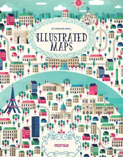
This book is a selection of different ways to interpret a map at the illustrative level. Several artists have created maps of the worlds most beautiful places and also its main cities, including Paris, Berlin, Dubai, Rio de Janeiro, and more. They are colourful illustrations in which each artist shows us his or her own way of working with lines and geometrical shapes, some very detailed or synthesised, some using computers or watercolours, and some simply using a pen.
$9.00 standard shipping within Australia
FREE standard shipping within Australia for orders over $100.00
Express & International shipping calculated at checkout
This book is a selection of different ways to interpret a map at the illustrative level. Several artists have created maps of the worlds most beautiful places and also its main cities, including Paris, Berlin, Dubai, Rio de Janeiro, and more. They are colourful illustrations in which each artist shows us his or her own way of working with lines and geometrical shapes, some very detailed or synthesised, some using computers or watercolours, and some simply using a pen.
Search our extensive online catalogue.
