Readings Newsletter
Become a Readings Member to make your shopping experience even easier.
Sign in or sign up for free!
You’re not far away from qualifying for FREE standard shipping within Australia
You’ve qualified for FREE standard shipping within Australia
The cart is loading…


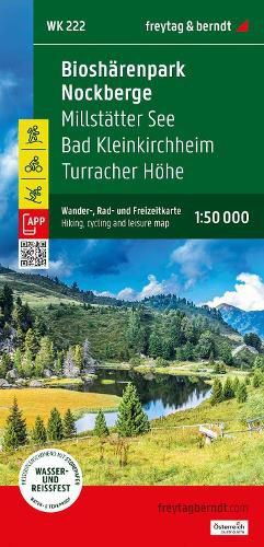
The hiking map 222 Bad Kleinkirchheim - Nockberge Biosphere Park - Lake Millstatt - Turracherhohe - Radenthein, 1:50,000 is revised regularly and contains updated information on hiking trails, cycle and mountain bike trails, huts, natural monuments, cultural sights and leisure facilities. The enclosed information booklet contains a selection of the best hiking trails, cycle paths and mountain bike routes as well as a brief description of the individual communities and their leisure activities. (Language: German) Leisure information, hiking and long-distance hiking trails, mountain bike and cycling tours, register of places with postcodes, GPS-compatible, bridle path, ski route, cross-country route, Nordic walking route, double-sided; Region: Nockberge, Millstatter See, Carinthia, Austria; Special themed hiking trails: Salzsteig long-distance hiking trail, Arnoweg, Way of St. James, Emma pilgrimage trail, Alpe-Adria Trail, Book Trail, Klomnock-Mallnock circular hike, Falkert circular hike; Special cycling and mountain bike tours: Alpe-Adria-Radweg, Millst?tter See Radweg, Turracher Radweg, Wimitz Radweg, W?lflbauerh?tte - Stubeck; Environment maps: WK 202, WK 221, WK 223, WK 224, WK 231, WK 233; Thanks to the detailed digital cartography and the precise scales, freytag & berndt hiking maps are ideal companions for hiking, mountaineering and ski tours. WK 233; Thanks to the detailed digital cartography and the precise scales, freytag & berndt hiking maps are ideal companions for hiking, mountaineering and ski tours. WK 233; Thanks to the detailed digital cartography and the precise scales, freytag & berndt hiking maps are ideal companions for hiking, mountaineering and ski tours.
$9.00 standard shipping within Australia
FREE standard shipping within Australia for orders over $100.00
Express & International shipping calculated at checkout
The hiking map 222 Bad Kleinkirchheim - Nockberge Biosphere Park - Lake Millstatt - Turracherhohe - Radenthein, 1:50,000 is revised regularly and contains updated information on hiking trails, cycle and mountain bike trails, huts, natural monuments, cultural sights and leisure facilities. The enclosed information booklet contains a selection of the best hiking trails, cycle paths and mountain bike routes as well as a brief description of the individual communities and their leisure activities. (Language: German) Leisure information, hiking and long-distance hiking trails, mountain bike and cycling tours, register of places with postcodes, GPS-compatible, bridle path, ski route, cross-country route, Nordic walking route, double-sided; Region: Nockberge, Millstatter See, Carinthia, Austria; Special themed hiking trails: Salzsteig long-distance hiking trail, Arnoweg, Way of St. James, Emma pilgrimage trail, Alpe-Adria Trail, Book Trail, Klomnock-Mallnock circular hike, Falkert circular hike; Special cycling and mountain bike tours: Alpe-Adria-Radweg, Millst?tter See Radweg, Turracher Radweg, Wimitz Radweg, W?lflbauerh?tte - Stubeck; Environment maps: WK 202, WK 221, WK 223, WK 224, WK 231, WK 233; Thanks to the detailed digital cartography and the precise scales, freytag & berndt hiking maps are ideal companions for hiking, mountaineering and ski tours. WK 233; Thanks to the detailed digital cartography and the precise scales, freytag & berndt hiking maps are ideal companions for hiking, mountaineering and ski tours. WK 233; Thanks to the detailed digital cartography and the precise scales, freytag & berndt hiking maps are ideal companions for hiking, mountaineering and ski tours.
Search our extensive online catalogue.
