Readings Newsletter
Become a Readings Member to make your shopping experience even easier.
Sign in or sign up for free!
You’re not far away from qualifying for FREE standard shipping within Australia
You’ve qualified for FREE standard shipping within Australia
The cart is loading…


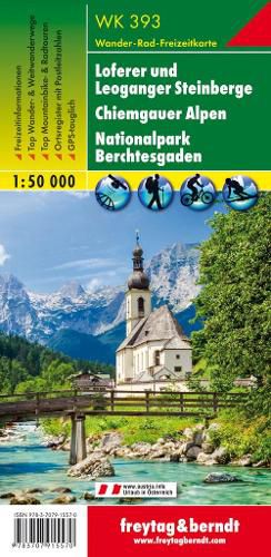
Freytag & Berndt hiking maps are the perfect companion for hiking, mountaineering and ski touring, thanks to detailed digital cartography and precise yardsticks. They are regularly revised and contain updated information on hiking trails, cycling and mountain biking trails, huts, natural monuments, cultural attractions and leisure facilities.
The enclosed information booklet contains a selection of the best hiking trails, cycle paths and mountain bike trails as well as a short description of the individual municipalities with their leisure time activities. (Language: German)
Leisure information, hiking and long-distance hiking trails, mountain biking and cycling tours, local register with zip codes, GPS-capable, via ferrata, ski route, cross-country route, Nordic walking trail.
Region: Chiemgau, Berchtesgaden, Bavaria, Loferer and Leoganger Steinberge, Salzburg, Tyrol
Special hiking theme trails:
Nordalpenweg, Voralpenweg, Rupertiweg, Via Alpina, Way of St. James, Arnweg, Adlerweg, Salzalpensteig, Leonhardweg, St. Rupert Pilgerweg, Alpenweitwanderweg, Berchtesgadener Hochthron, 2-Watzmann Hocheck
Special cycling tours:
Mozart Cycle Path, Chiemgau Cycle Path, Tauern Cycle Path, Saalachtal Cycle Path, Lake Constance-Koenigssee Cycle Path, Bike Trail Tirol, Watzmann-Hochkoenig Round, Waidringer Panoramaweg, to Diessbach Reservoir
$9.00 standard shipping within Australia
FREE standard shipping within Australia for orders over $100.00
Express & International shipping calculated at checkout
Freytag & Berndt hiking maps are the perfect companion for hiking, mountaineering and ski touring, thanks to detailed digital cartography and precise yardsticks. They are regularly revised and contain updated information on hiking trails, cycling and mountain biking trails, huts, natural monuments, cultural attractions and leisure facilities.
The enclosed information booklet contains a selection of the best hiking trails, cycle paths and mountain bike trails as well as a short description of the individual municipalities with their leisure time activities. (Language: German)
Leisure information, hiking and long-distance hiking trails, mountain biking and cycling tours, local register with zip codes, GPS-capable, via ferrata, ski route, cross-country route, Nordic walking trail.
Region: Chiemgau, Berchtesgaden, Bavaria, Loferer and Leoganger Steinberge, Salzburg, Tyrol
Special hiking theme trails:
Nordalpenweg, Voralpenweg, Rupertiweg, Via Alpina, Way of St. James, Arnweg, Adlerweg, Salzalpensteig, Leonhardweg, St. Rupert Pilgerweg, Alpenweitwanderweg, Berchtesgadener Hochthron, 2-Watzmann Hocheck
Special cycling tours:
Mozart Cycle Path, Chiemgau Cycle Path, Tauern Cycle Path, Saalachtal Cycle Path, Lake Constance-Koenigssee Cycle Path, Bike Trail Tirol, Watzmann-Hochkoenig Round, Waidringer Panoramaweg, to Diessbach Reservoir
Search our extensive online catalogue.
