Readings Newsletter
Become a Readings Member to make your shopping experience even easier.
Sign in or sign up for free!
You’re not far away from qualifying for FREE standard shipping within Australia
You’ve qualified for FREE standard shipping within Australia
The cart is loading…


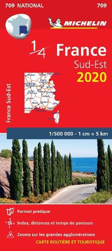
Michelin Southeastern France 709 will give you an detailed picture of your journey from Montpellier to Nice and Bourges to Besancon thanks to its clear and accurate mapping scale 1/500,000. Our map will help you easily plan your safe and enjoyable journey in the southwestern parts of France thanks to a comprehensive key, a complete name index as well a clever time & distance chart. Michelin's driving information will help you navigate safely in all circumstances. Furthermore this map features zoom on major cities and towns as well as QR codes to the complete your journey with Via Michelin. This map includes tourist sights, scenic route and is cross-referenced with the famous MICHELIN Green Guide highlighting destinations worth stopping for! With MICHELIN National Maps, find more than just your way!
MICHELIN NATIONAL MAPS feature:
Up-to-date mapping A scale adapted to the size of the country A clear and comprehensive key Distance and time chart Place name index Driving and road safety information Tourist sights information
$9.00 standard shipping within Australia
FREE standard shipping within Australia for orders over $100.00
Express & International shipping calculated at checkout
Michelin Southeastern France 709 will give you an detailed picture of your journey from Montpellier to Nice and Bourges to Besancon thanks to its clear and accurate mapping scale 1/500,000. Our map will help you easily plan your safe and enjoyable journey in the southwestern parts of France thanks to a comprehensive key, a complete name index as well a clever time & distance chart. Michelin's driving information will help you navigate safely in all circumstances. Furthermore this map features zoom on major cities and towns as well as QR codes to the complete your journey with Via Michelin. This map includes tourist sights, scenic route and is cross-referenced with the famous MICHELIN Green Guide highlighting destinations worth stopping for! With MICHELIN National Maps, find more than just your way!
MICHELIN NATIONAL MAPS feature:
Up-to-date mapping A scale adapted to the size of the country A clear and comprehensive key Distance and time chart Place name index Driving and road safety information Tourist sights information
Search our extensive online catalogue.
