Readings Newsletter
Become a Readings Member to make your shopping experience even easier.
Sign in or sign up for free!
You’re not far away from qualifying for FREE standard shipping within Australia
You’ve qualified for FREE standard shipping within Australia
The cart is loading…


This title is printed to order. This book may have been self-published. If so, we cannot guarantee the quality of the content. In the main most books will have gone through the editing process however some may not. We therefore suggest that you be aware of this before ordering this book. If in doubt check either the author or publisher’s details as we are unable to accept any returns unless they are faulty. Please contact us if you have any questions.
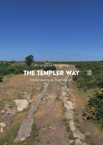
A helpful and practical pocket guide to walking the long-distance Templer Way path.
The Templer Way, starting in Haytor, links the picturesque National Park Dartmoor with the coastal town of Teignmouth. This trail begins where tramways once quarried granite in the early nineteenth century. From Haytor, the trail passes down through the historic town of Bovey Tracey where it joins up with the Stover Canal. From here, the route leads onwards through the market town of Newton Abbot. The final leg follows alongside the southern shore of the Teign Estuary to Shaldon. To reach the finishing point, enjoy a crossing on the Teign Ferry, traced back to 1296. You will now arrive in Teignmouth where this journey ends and another may begin.
This guide contains:
Detailed 1:25 000 OS maps covering the entire route Directions for the route broken down into easily manageable legs A suggested kit list, also available for free to download Places of interest and village amenities such as historic locations, accommodation, eateries, and public facilities A full six-figure and eight-figure grid reference for GPS reference Colour photography throughout Travel information
$9.00 standard shipping within Australia
FREE standard shipping within Australia for orders over $100.00
Express & International shipping calculated at checkout
This title is printed to order. This book may have been self-published. If so, we cannot guarantee the quality of the content. In the main most books will have gone through the editing process however some may not. We therefore suggest that you be aware of this before ordering this book. If in doubt check either the author or publisher’s details as we are unable to accept any returns unless they are faulty. Please contact us if you have any questions.
A helpful and practical pocket guide to walking the long-distance Templer Way path.
The Templer Way, starting in Haytor, links the picturesque National Park Dartmoor with the coastal town of Teignmouth. This trail begins where tramways once quarried granite in the early nineteenth century. From Haytor, the trail passes down through the historic town of Bovey Tracey where it joins up with the Stover Canal. From here, the route leads onwards through the market town of Newton Abbot. The final leg follows alongside the southern shore of the Teign Estuary to Shaldon. To reach the finishing point, enjoy a crossing on the Teign Ferry, traced back to 1296. You will now arrive in Teignmouth where this journey ends and another may begin.
This guide contains:
Detailed 1:25 000 OS maps covering the entire route Directions for the route broken down into easily manageable legs A suggested kit list, also available for free to download Places of interest and village amenities such as historic locations, accommodation, eateries, and public facilities A full six-figure and eight-figure grid reference for GPS reference Colour photography throughout Travel information
Search our extensive online catalogue.
