Readings Newsletter
Become a Readings Member to make your shopping experience even easier.
Sign in or sign up for free!
You’re not far away from qualifying for FREE standard shipping within Australia
You’ve qualified for FREE standard shipping within Australia
The cart is loading…


This title is printed to order. This book may have been self-published. If so, we cannot guarantee the quality of the content. In the main most books will have gone through the editing process however some may not. We therefore suggest that you be aware of this before ordering this book. If in doubt check either the author or publisher’s details as we are unable to accept any returns unless they are faulty. Please contact us if you have any questions.
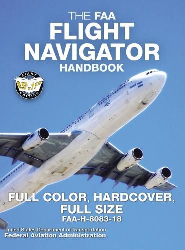
THE ESSENTIAL GUIDE TO PRACTICAL, SAFE AIR NAVIGATION
FULL COLOR THROUGHOUT: the theory and practice of air navigation cannot be fully explained or adequately understood with black-and-white illustrations; color is vital. This edition uses full color from start to finish. FULL-SIZE 8.5 x 11 edition: large, easy-to-read text and illustrations. CASEBOUND: hardcover binding looks great and protects your book from everyday damage. Printed on PREMIUM-WEIGHT 70 lb paper stock for superior quality & longevity: ideal for professional libraries!
Aviators use air navigation to determine where they are going and how to get there. This handbook serves as a reference for techniques and methods used in these critical skills, covering all aspects of air navigation for navigators and students, including how to measure, chart the earth, and use flight instruments to solve navigation problems.
It also provides information on flight publications, in-flight procedures and low-altitude navigation, and includes reference and supporting material covering mathematical equations, chart and navigational symbols, and celestial computation aids.
MAPS & CHARTS - FLIGHT PLANNING - BASIC INSTRUMENTS - DEAD RECKONING - RADIO AID FIXING - MAP READING - RADAR NAVIGATION - CELESTIAL CONCEPTS - COMPUTING ALTITUDE AND TRUE AZIMUTH - CELESTIAL PRECOMPUTATION - PLOTTING & INTERPRETING THE CELESTIAL LINE OF POSITION - SPECIAL CELESTIAL TECHNIQUES - SEXTANTS & ERRORS OF OBSERVATION - GRID NAVIGATION - PRESSURE PATTERN NAVIGATION - NAVIGATION SYSTEMS - REFERENCES - MATHEMATICAL FORMULAS - CHART & NAVIGATION SYMBOLS - CELESTIAL COMPUTATION SHEET - GLOSSARY - INDEX
Proudly published in the USA by Carlile Aviation Library
$9.00 standard shipping within Australia
FREE standard shipping within Australia for orders over $100.00
Express & International shipping calculated at checkout
This title is printed to order. This book may have been self-published. If so, we cannot guarantee the quality of the content. In the main most books will have gone through the editing process however some may not. We therefore suggest that you be aware of this before ordering this book. If in doubt check either the author or publisher’s details as we are unable to accept any returns unless they are faulty. Please contact us if you have any questions.
THE ESSENTIAL GUIDE TO PRACTICAL, SAFE AIR NAVIGATION
FULL COLOR THROUGHOUT: the theory and practice of air navigation cannot be fully explained or adequately understood with black-and-white illustrations; color is vital. This edition uses full color from start to finish. FULL-SIZE 8.5 x 11 edition: large, easy-to-read text and illustrations. CASEBOUND: hardcover binding looks great and protects your book from everyday damage. Printed on PREMIUM-WEIGHT 70 lb paper stock for superior quality & longevity: ideal for professional libraries!
Aviators use air navigation to determine where they are going and how to get there. This handbook serves as a reference for techniques and methods used in these critical skills, covering all aspects of air navigation for navigators and students, including how to measure, chart the earth, and use flight instruments to solve navigation problems.
It also provides information on flight publications, in-flight procedures and low-altitude navigation, and includes reference and supporting material covering mathematical equations, chart and navigational symbols, and celestial computation aids.
MAPS & CHARTS - FLIGHT PLANNING - BASIC INSTRUMENTS - DEAD RECKONING - RADIO AID FIXING - MAP READING - RADAR NAVIGATION - CELESTIAL CONCEPTS - COMPUTING ALTITUDE AND TRUE AZIMUTH - CELESTIAL PRECOMPUTATION - PLOTTING & INTERPRETING THE CELESTIAL LINE OF POSITION - SPECIAL CELESTIAL TECHNIQUES - SEXTANTS & ERRORS OF OBSERVATION - GRID NAVIGATION - PRESSURE PATTERN NAVIGATION - NAVIGATION SYSTEMS - REFERENCES - MATHEMATICAL FORMULAS - CHART & NAVIGATION SYMBOLS - CELESTIAL COMPUTATION SHEET - GLOSSARY - INDEX
Proudly published in the USA by Carlile Aviation Library
Search our extensive online catalogue.
