Readings Newsletter
Become a Readings Member to make your shopping experience even easier.
Sign in or sign up for free!
You’re not far away from qualifying for FREE standard shipping within Australia
You’ve qualified for FREE standard shipping within Australia
The cart is loading…


Note: This guide is based on the January 2017 release of the Autodesk® InfraWorks® 360 software. There might be slight differences between the software used in this student guide and other versions of the software. In order to complete all the exercises, a total of 152 cloud credits are required. If you do not have enough cloud credits for some of the exercises, you can jump to the next task by switching to the proposal indicated in the text.
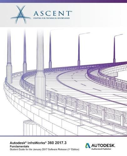
The Autodesk® InfraWorks® 360 2017.3 Fundamentals student guide is designed for people using any of the following software packages:
Autodesk® InfraWorks® 360 LT
Autodesk® InfraWorks® 360
The training guide provides you with a fundamental knowledge of the accelerated design process that uses data-rich 3D models with high-end visualizations. This enables you to create, evaluate, and better communicate 3D site plan proposals for faster approvals.
Topics Covered
Navigate the Autodesk InfraWorks 360 user interface
Create new models from scratch
Incorporate existing data sources into the model
Add essential design elements to the model
Display features according to data behind the model
Create new styles according to project requirements
Analyze a model to ensure that project constraints are met
Collaborate with other project team members
Create high-impact visualizations of the project for better communication
Generate videos by using storyboards
Use the Roadway Design for InfraWorks 360 module to:
Create property boundaries for parcels, easements, and right-of-ways
Create and modify design roads with precise parameters
Design a road using component roads
Adjust roadside grading
Apply and review suprerelevations in component roads
Modify how design roads intersect using a standard intersection or roundabout
Optimize the vertical design of a roadway
Create gradient maps based on selected feature sets to identify areas with low impact for site or corridor optimization
Find an optimal horizontal design of the roadway which yields a cost effective and environmentally-friendly solution
Run traffic simulation to analyze and animate design traffic
Use the Bridge Design for InfraWorks 360 Module to:
Add bridges to a design roadway
Work with bridge deck and girder cross sections
Perform analysis and design checks on all the pre-stressed girders of your bridge
Use the Drainage Design for InfraWorks 360 Module to:
Run a watershed analysis
Create or modify culverts
Create a pavement drainage network
Analyze the pavement drainage network
Prerequisites
A fundamental understanding and knowledge of civil engineering terminology.
$9.00 standard shipping within Australia
FREE standard shipping within Australia for orders over $100.00
Express & International shipping calculated at checkout
Stock availability can be subject to change without notice. We recommend calling the shop or contacting our online team to check availability of low stock items. Please see our Shopping Online page for more details.
Note: This guide is based on the January 2017 release of the Autodesk® InfraWorks® 360 software. There might be slight differences between the software used in this student guide and other versions of the software. In order to complete all the exercises, a total of 152 cloud credits are required. If you do not have enough cloud credits for some of the exercises, you can jump to the next task by switching to the proposal indicated in the text.
The Autodesk® InfraWorks® 360 2017.3 Fundamentals student guide is designed for people using any of the following software packages:
Autodesk® InfraWorks® 360 LT
Autodesk® InfraWorks® 360
The training guide provides you with a fundamental knowledge of the accelerated design process that uses data-rich 3D models with high-end visualizations. This enables you to create, evaluate, and better communicate 3D site plan proposals for faster approvals.
Topics Covered
Navigate the Autodesk InfraWorks 360 user interface
Create new models from scratch
Incorporate existing data sources into the model
Add essential design elements to the model
Display features according to data behind the model
Create new styles according to project requirements
Analyze a model to ensure that project constraints are met
Collaborate with other project team members
Create high-impact visualizations of the project for better communication
Generate videos by using storyboards
Use the Roadway Design for InfraWorks 360 module to:
Create property boundaries for parcels, easements, and right-of-ways
Create and modify design roads with precise parameters
Design a road using component roads
Adjust roadside grading
Apply and review suprerelevations in component roads
Modify how design roads intersect using a standard intersection or roundabout
Optimize the vertical design of a roadway
Create gradient maps based on selected feature sets to identify areas with low impact for site or corridor optimization
Find an optimal horizontal design of the roadway which yields a cost effective and environmentally-friendly solution
Run traffic simulation to analyze and animate design traffic
Use the Bridge Design for InfraWorks 360 Module to:
Add bridges to a design roadway
Work with bridge deck and girder cross sections
Perform analysis and design checks on all the pre-stressed girders of your bridge
Use the Drainage Design for InfraWorks 360 Module to:
Run a watershed analysis
Create or modify culverts
Create a pavement drainage network
Analyze the pavement drainage network
Prerequisites
A fundamental understanding and knowledge of civil engineering terminology.