Readings Newsletter
Become a Readings Member to make your shopping experience even easier.
Sign in or sign up for free!
You’re not far away from qualifying for FREE standard shipping within Australia
You’ve qualified for FREE standard shipping within Australia
The cart is loading…


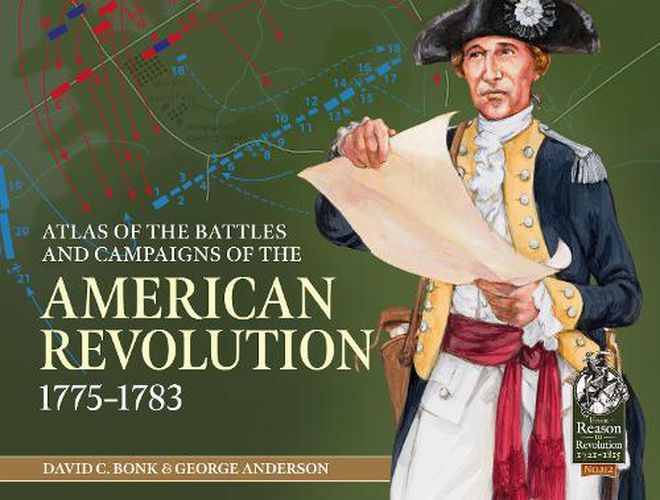
The Atlas of Battles and Campaigns of the American Revolution provides a comprehensive visual summary of the campaigns, major battles and minor skirmishes of the war. The atlas includes over 120 maps created using maps from the Revolution, including the large collection from the US Library of Congress and enhanced with more accurate topographic mapping from the 1880s. The maps also show troop dispositions and movements taken from a wide range of written sources to provide the most accurate representation of the battles and campaigns. The Atlas will be a valuable resource for anyone with an interest in the American Revolution, including wargamers, reenactors, and students of the conflict. Beginning with the opening skirmishes at Lexington and Concord, The Atlas follows the course of the war including the major engagements at Brooklyn, Trenton, Brandywine, Saratoga, Monmouth, Savannah, Guilford Courthouse and Yorktown. It includes a large collection of minor actions, including Harlem Heights, White Plains, Short Hills, Barren Hill, Stony Point, Hobkirk’s Hill and Green Springs. The Atlas also addresses critical naval battles as well as key engagements in the West Indies, Gibraltar, and India.The Atlas of the Battles and Campaigns of the American Revolution includes over 120 full color maps showing troop dispositions and topography for both the major engagements of the conflict as well as many lesser-known but critical battles and skirmishes. AUTHORS: David C. Bonk has written several books covering battles of the American Revolution and World War I, including Trenton/Princeton and Belleau Wood. He is a lifelong student of military history and historical simulations including computer, board games, and miniature wargames. He is a former board member of the Historical Miniatures Gaming Society. George Anderson Served almost 11 years in the Royal Navy then worked offshore in the North Sea for 20 years as a Radio Operator, before buying a Post Office in a small English village in 2000. He began drawing maps for his own successful American Civil War series beginning in 1990, and then went professional mainly working with Helion & Co. He is a passionate wargamer with a large collection covering armies from 200BC to 1945. 120 colour maps
$9.00 standard shipping within Australia
FREE standard shipping within Australia for orders over $100.00
Express & International shipping calculated at checkout
The Atlas of Battles and Campaigns of the American Revolution provides a comprehensive visual summary of the campaigns, major battles and minor skirmishes of the war. The atlas includes over 120 maps created using maps from the Revolution, including the large collection from the US Library of Congress and enhanced with more accurate topographic mapping from the 1880s. The maps also show troop dispositions and movements taken from a wide range of written sources to provide the most accurate representation of the battles and campaigns. The Atlas will be a valuable resource for anyone with an interest in the American Revolution, including wargamers, reenactors, and students of the conflict. Beginning with the opening skirmishes at Lexington and Concord, The Atlas follows the course of the war including the major engagements at Brooklyn, Trenton, Brandywine, Saratoga, Monmouth, Savannah, Guilford Courthouse and Yorktown. It includes a large collection of minor actions, including Harlem Heights, White Plains, Short Hills, Barren Hill, Stony Point, Hobkirk’s Hill and Green Springs. The Atlas also addresses critical naval battles as well as key engagements in the West Indies, Gibraltar, and India.The Atlas of the Battles and Campaigns of the American Revolution includes over 120 full color maps showing troop dispositions and topography for both the major engagements of the conflict as well as many lesser-known but critical battles and skirmishes. AUTHORS: David C. Bonk has written several books covering battles of the American Revolution and World War I, including Trenton/Princeton and Belleau Wood. He is a lifelong student of military history and historical simulations including computer, board games, and miniature wargames. He is a former board member of the Historical Miniatures Gaming Society. George Anderson Served almost 11 years in the Royal Navy then worked offshore in the North Sea for 20 years as a Radio Operator, before buying a Post Office in a small English village in 2000. He began drawing maps for his own successful American Civil War series beginning in 1990, and then went professional mainly working with Helion & Co. He is a passionate wargamer with a large collection covering armies from 200BC to 1945. 120 colour maps