Readings Newsletter
Become a Readings Member to make your shopping experience even easier.
Sign in or sign up for free!
You’re not far away from qualifying for FREE standard shipping within Australia
You’ve qualified for FREE standard shipping within Australia
The cart is loading…


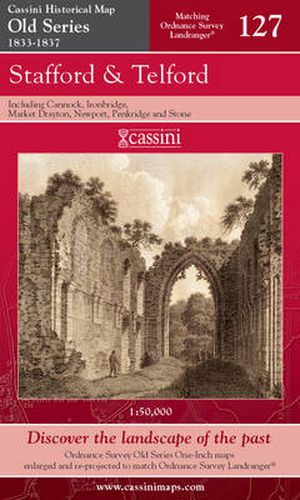
These maps are based on Britain’s first national mapping project, the One-Inch (‘Old Series’) Ordnance Survey maps which were first published between 1805 and 1874. They have all been carefully scanned, digitally re-projected and enlarged to match the present-day Ordnance Survey Landranger® Map series. Each Timeline Historical Map is directly comparable with the corresponding Ordnance Survey Landranger® map and uses the same sheet number and grid references, so enabling the past and the present to compared with ease and accuracy. All the Old Series maps of England & Wales (123 in all) have now been published
$9.00 standard shipping within Australia
FREE standard shipping within Australia for orders over $100.00
Express & International shipping calculated at checkout
These maps are based on Britain’s first national mapping project, the One-Inch (‘Old Series’) Ordnance Survey maps which were first published between 1805 and 1874. They have all been carefully scanned, digitally re-projected and enlarged to match the present-day Ordnance Survey Landranger® Map series. Each Timeline Historical Map is directly comparable with the corresponding Ordnance Survey Landranger® map and uses the same sheet number and grid references, so enabling the past and the present to compared with ease and accuracy. All the Old Series maps of England & Wales (123 in all) have now been published
Search our extensive online catalogue.
