Readings Newsletter
Become a Readings Member to make your shopping experience even easier.
Sign in or sign up for free!
You’re not far away from qualifying for FREE standard shipping within Australia
You’ve qualified for FREE standard shipping within Australia
The cart is loading…


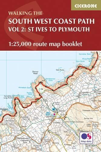
The South West Coast Path is Britains longest National Trail, stretching some 630 miles (1014km) between Minehead in Somerset and Poole in Dorset. It takes in a National Park, 5 Areas of Outstanding Natural Beauty, National Heritage Coasts and a UNESCO World Heritage Site. This booklet of Ordnance Survey 1:25,000 Explorer maps has been designed for convenient use on the trail, covering part of the southern section of the route between St Ives and Plymouth. It shows the full and up-to-date line of the National Trail, along with the relevant extract from the OS Explorer map legend. It is conveniently sized for slipping into a jacket pocket or top of a rucksack and comes in a clear PVC sleeve. Two separate booklets cover the rest of the route, from Minehead to St Ives and from Plymouth to Poole. The map booklet can accompany the Cicerone guidebook to The South West Coast Path - which describes the full National Trail in 45 stages, with lots of other practical information and local points of interest.
$9.00 standard shipping within Australia
FREE standard shipping within Australia for orders over $100.00
Express & International shipping calculated at checkout
The South West Coast Path is Britains longest National Trail, stretching some 630 miles (1014km) between Minehead in Somerset and Poole in Dorset. It takes in a National Park, 5 Areas of Outstanding Natural Beauty, National Heritage Coasts and a UNESCO World Heritage Site. This booklet of Ordnance Survey 1:25,000 Explorer maps has been designed for convenient use on the trail, covering part of the southern section of the route between St Ives and Plymouth. It shows the full and up-to-date line of the National Trail, along with the relevant extract from the OS Explorer map legend. It is conveniently sized for slipping into a jacket pocket or top of a rucksack and comes in a clear PVC sleeve. Two separate booklets cover the rest of the route, from Minehead to St Ives and from Plymouth to Poole. The map booklet can accompany the Cicerone guidebook to The South West Coast Path - which describes the full National Trail in 45 stages, with lots of other practical information and local points of interest.
Search our extensive online catalogue.
