Readings Newsletter
Become a Readings Member to make your shopping experience even easier.
Sign in or sign up for free!
You’re not far away from qualifying for FREE standard shipping within Australia
You’ve qualified for FREE standard shipping within Australia
The cart is loading…


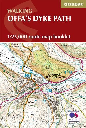
All the mapping you need to walk the Offa’s Dyke Path National Trail that runs for 177 miles along the English-Welsh border between Sedbury (near Chepstow) and Prestatyn on the north Wales Coast.
NOTE An accompanying Cicerone guidebook - Offa’s Dyke Path - describes the full route from south to north with lots of other practical and historical information. The accompanying guidebook INCLUDES a copy of this map booklet. This booklet of Ordnance Survey 1:25,000 Explorer maps is conveniently sized for slipping into a jacket pocket or top of a rucksack and comes in a clear PVC sleeve. It shows the full and up-to-date line of the Offa’s Dyke Path, along with the relevant extract from the OS Explorer map legend.
$9.00 standard shipping within Australia
FREE standard shipping within Australia for orders over $100.00
Express & International shipping calculated at checkout
All the mapping you need to walk the Offa’s Dyke Path National Trail that runs for 177 miles along the English-Welsh border between Sedbury (near Chepstow) and Prestatyn on the north Wales Coast.
NOTE An accompanying Cicerone guidebook - Offa’s Dyke Path - describes the full route from south to north with lots of other practical and historical information. The accompanying guidebook INCLUDES a copy of this map booklet. This booklet of Ordnance Survey 1:25,000 Explorer maps is conveniently sized for slipping into a jacket pocket or top of a rucksack and comes in a clear PVC sleeve. It shows the full and up-to-date line of the Offa’s Dyke Path, along with the relevant extract from the OS Explorer map legend.
Search our extensive online catalogue.
