Readings Newsletter
Become a Readings Member to make your shopping experience even easier.
Sign in or sign up for free!
You’re not far away from qualifying for FREE standard shipping within Australia
You’ve qualified for FREE standard shipping within Australia
The cart is loading…


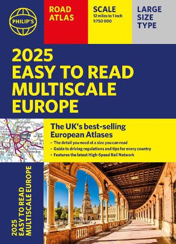
PHILIP'S: THE BEST-SELLING EUROPEAN ATLAS RANGE IN THE UK
With the detail you need at a size you can read, the latest 2025 Philip's Easy to Read Multiscale Road Atlas of Europe is the ultimate driving companion. Including the rules and regulations across Europe for easy driving, and the high speed network if you need to take to the train.
Super-clear main scale at 1:750,000 (12 miles to 1 inch)
Multiscale mapping with scales from 1:200,000 to 1:3M, showing more detail where you need it
Clear mapping of every country in Europe and the driving rules and regulations
Distance Chart and a 23-page route planning section included, for easy route planning across long distances
Spectacular scenic routes clearly highlighted
Including a handy map of Europe's High-Speed Rail Network to help plan long distance journeys with ease
A4 format with sturdy flaps
'The clearest and most detailed maps of Europe' David Williams MBE, former CEO Gem Motoring Assist
'The best of its kind with quick, easy-to-use information' Fleet Week
$9.00 standard shipping within Australia
FREE standard shipping within Australia for orders over $100.00
Express & International shipping calculated at checkout
PHILIP'S: THE BEST-SELLING EUROPEAN ATLAS RANGE IN THE UK
With the detail you need at a size you can read, the latest 2025 Philip's Easy to Read Multiscale Road Atlas of Europe is the ultimate driving companion. Including the rules and regulations across Europe for easy driving, and the high speed network if you need to take to the train.
Super-clear main scale at 1:750,000 (12 miles to 1 inch)
Multiscale mapping with scales from 1:200,000 to 1:3M, showing more detail where you need it
Clear mapping of every country in Europe and the driving rules and regulations
Distance Chart and a 23-page route planning section included, for easy route planning across long distances
Spectacular scenic routes clearly highlighted
Including a handy map of Europe's High-Speed Rail Network to help plan long distance journeys with ease
A4 format with sturdy flaps
'The clearest and most detailed maps of Europe' David Williams MBE, former CEO Gem Motoring Assist
'The best of its kind with quick, easy-to-use information' Fleet Week
Search our extensive online catalogue.
