Readings Newsletter
Become a Readings Member to make your shopping experience even easier.
Sign in or sign up for free!
You’re not far away from qualifying for FREE standard shipping within Australia
You’ve qualified for FREE standard shipping within Australia
The cart is loading…


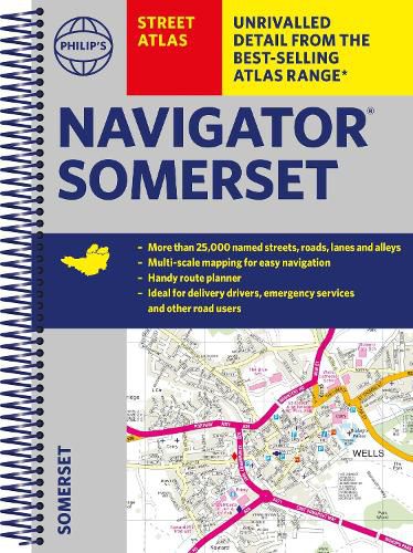
The only county atlas with all the named streets of Somerset - more than 24,000 named streets, roads, lanes and alleys - ideal for finding the best and most effective route anywhere in the area.
Includes all the streets in BATH, BRIDGWATER, FROME, TAUNTON, WESTON-SUPER-MARE, YEOVIL, Bruton, Burnham-on-Sea, Castle Cary, Chard, Crewkerne, Clevedon, Cheddar, Glastonbury, Ilminster, Keynsham, Minehead, Midsomer Norton, Nailsea, Portishead, Sherborne, Shepton Mallet, Street, Somerton, Wincanton, Watchet, Wedmore, Wells, Wellington, Yatton.
With Super-clear mapping, it is routinely used by the emergency services and professional drivers. The Route planner section shows all the A and B roads and can be used to get close to the destination before turning to the relevant large-scale street map.
Packed with useful information including car parks, railway and bus stations, post offices, schools, colleges, universities, hospitals, police and fire stations, places of worship, leisure centres, footpaths and bridleways, camping and caravan sites, golf-courses, and many other places of interest.
All this and an easy-to-use comprehensive Index with colour-coding for quick reference.
$9.00 standard shipping within Australia
FREE standard shipping within Australia for orders over $100.00
Express & International shipping calculated at checkout
The only county atlas with all the named streets of Somerset - more than 24,000 named streets, roads, lanes and alleys - ideal for finding the best and most effective route anywhere in the area.
Includes all the streets in BATH, BRIDGWATER, FROME, TAUNTON, WESTON-SUPER-MARE, YEOVIL, Bruton, Burnham-on-Sea, Castle Cary, Chard, Crewkerne, Clevedon, Cheddar, Glastonbury, Ilminster, Keynsham, Minehead, Midsomer Norton, Nailsea, Portishead, Sherborne, Shepton Mallet, Street, Somerton, Wincanton, Watchet, Wedmore, Wells, Wellington, Yatton.
With Super-clear mapping, it is routinely used by the emergency services and professional drivers. The Route planner section shows all the A and B roads and can be used to get close to the destination before turning to the relevant large-scale street map.
Packed with useful information including car parks, railway and bus stations, post offices, schools, colleges, universities, hospitals, police and fire stations, places of worship, leisure centres, footpaths and bridleways, camping and caravan sites, golf-courses, and many other places of interest.
All this and an easy-to-use comprehensive Index with colour-coding for quick reference.
Search our extensive online catalogue.
