Readings Newsletter
Become a Readings Member to make your shopping experience even easier.
Sign in or sign up for free!
You’re not far away from qualifying for FREE standard shipping within Australia
You’ve qualified for FREE standard shipping within Australia
The cart is loading…


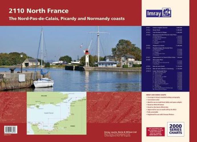
A new edition of the atlas North France, consisting of 6 double-sided sheets covering the coast from Nieuwpoort (Belgium) to Cherbourg.The atlas consists of the following:1. Eastern English Channel (1:600 000)2. Dover Strait (1:200 000)3. Cap Gris-Nez to Dieppe (1:200 000)4. Nieuwpoort & Nord-Pas-de-Calais PlansA. Nieuwpoort (1:30 000), B. Rade de Dunkerque (1:125 000), C. Dunkerque (1:25 000), D. Calais (1:20 000), E. Boulogne-sur-Mer (1:25 000), F. Etaples (1:75 000)5. Dieppe to Le Havre (1:200 000)6. Picardy & Upper Normandy PlansA. Baie de Somme (1:75 000), B. Le Treport (1:12 500), C. Dieppe (1:12 500), D. St-Valery-en-Caux (1:12 500), E. Fecamp (1:12 500)7. Approaches to Le Havre & River Seine (1:60 000)8. River Seine PlansA. Le Havre (1:17 500), B. River Seine to Tancarville (1:63 000), C. Honfleur (1:12 500)9. Baie de Seine (East) (1:155 000)10. Baie de Seine (West) to Cherbourg (1:155 000)11. Lower Normandy PlansA. Deauville/Trouville (1:15 000), B. Dives-sur-Mer (1:30 000), C. Ouistreham (1:25 000), D. Courseulles-sur-Mer (1:20 000), E. Arromanches (1:35 000), F. Port-en-Bessin (1:10 000), G. Grandcamp-Maisy (1:6000), H. Baie du Grand Vey (1:75 000), I.Saint-Vaast-la-Hougue (1:20 000), J. Barfleur (1:15 000), K. Cherbourg (1:40 000), L. Port Chantereyne (Cherbourg) (1:10 000), M. Omonville-la-Rogue (1:7000)
$9.00 standard shipping within Australia
FREE standard shipping within Australia for orders over $100.00
Express & International shipping calculated at checkout
A new edition of the atlas North France, consisting of 6 double-sided sheets covering the coast from Nieuwpoort (Belgium) to Cherbourg.The atlas consists of the following:1. Eastern English Channel (1:600 000)2. Dover Strait (1:200 000)3. Cap Gris-Nez to Dieppe (1:200 000)4. Nieuwpoort & Nord-Pas-de-Calais PlansA. Nieuwpoort (1:30 000), B. Rade de Dunkerque (1:125 000), C. Dunkerque (1:25 000), D. Calais (1:20 000), E. Boulogne-sur-Mer (1:25 000), F. Etaples (1:75 000)5. Dieppe to Le Havre (1:200 000)6. Picardy & Upper Normandy PlansA. Baie de Somme (1:75 000), B. Le Treport (1:12 500), C. Dieppe (1:12 500), D. St-Valery-en-Caux (1:12 500), E. Fecamp (1:12 500)7. Approaches to Le Havre & River Seine (1:60 000)8. River Seine PlansA. Le Havre (1:17 500), B. River Seine to Tancarville (1:63 000), C. Honfleur (1:12 500)9. Baie de Seine (East) (1:155 000)10. Baie de Seine (West) to Cherbourg (1:155 000)11. Lower Normandy PlansA. Deauville/Trouville (1:15 000), B. Dives-sur-Mer (1:30 000), C. Ouistreham (1:25 000), D. Courseulles-sur-Mer (1:20 000), E. Arromanches (1:35 000), F. Port-en-Bessin (1:10 000), G. Grandcamp-Maisy (1:6000), H. Baie du Grand Vey (1:75 000), I.Saint-Vaast-la-Hougue (1:20 000), J. Barfleur (1:15 000), K. Cherbourg (1:40 000), L. Port Chantereyne (Cherbourg) (1:10 000), M. Omonville-la-Rogue (1:7000)
Search our extensive online catalogue.
