Readings Newsletter
Become a Readings Member to make your shopping experience even easier.
Sign in or sign up for free!
You’re not far away from qualifying for FREE standard shipping within Australia
You’ve qualified for FREE standard shipping within Australia
The cart is loading…


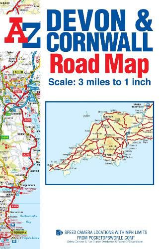
This A-Z map of Devon and Cornwall is a full colour, single sided, fold-out road map which covers both counties. This map extends to also cover: *Weston-super-Mare *Bridgwater *Taunton *Minehead *Bridport *Lyme Regis
Map detail is shown at a clear 2 kms to 1 cm (3.156 miles to 1 inch) and includes the following features: *Motorways open with full junction detail, motorways under construction and proposed, service areas, primary routes and destinations, A & B roads, gradients 1:5 and steeper, tolls, mileages, national and county boundaries, together with spot heights and hill shading. *Selected safety camera locations with their maximum speed limits and fuel stations. *Exmoor and Dartmoor National Parks. *Selected places of interest, tourist information centres and golf courses.
The index section includes a list of cities, towns, villages, hamlets and locations and is featured below the map.
$9.00 standard shipping within Australia
FREE standard shipping within Australia for orders over $100.00
Express & International shipping calculated at checkout
This A-Z map of Devon and Cornwall is a full colour, single sided, fold-out road map which covers both counties. This map extends to also cover: *Weston-super-Mare *Bridgwater *Taunton *Minehead *Bridport *Lyme Regis
Map detail is shown at a clear 2 kms to 1 cm (3.156 miles to 1 inch) and includes the following features: *Motorways open with full junction detail, motorways under construction and proposed, service areas, primary routes and destinations, A & B roads, gradients 1:5 and steeper, tolls, mileages, national and county boundaries, together with spot heights and hill shading. *Selected safety camera locations with their maximum speed limits and fuel stations. *Exmoor and Dartmoor National Parks. *Selected places of interest, tourist information centres and golf courses.
The index section includes a list of cities, towns, villages, hamlets and locations and is featured below the map.
Search our extensive online catalogue.
