Readings Newsletter
Become a Readings Member to make your shopping experience even easier.
Sign in or sign up for free!
You’re not far away from qualifying for FREE standard shipping within Australia
You’ve qualified for FREE standard shipping within Australia
The cart is loading…


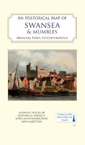
A full colour map, based on digitised OS maps of Swansea of about 1919, with its medieval past overlain and important buildings picked out. The map includes an inset map of Mumbles and its medieval castle.
In the Middle Ages, Swansea (Abertawe) became a centre for trade around the mouth of the river Tawe. Following Norman control of the area, Swansea Castle was established in the early 12th century and a borough charter was granted at the end of that century.
Great growth began in the 17th century with the establishment of copper-smelting in the area of the lower Tawe valley, an industry which grew until Swansea was the world capital of the copper industry - hence its nickname of ‘Copperopolis’. Initially using ore from Cornwall, Swansea took advantage of its local coal resources and its good port facilities to process copper, arsenic, tin, gold and other metals, using imported raw materials from all over the world. The port exported the final products, along with many tons of coal.
At the time of the background map shown here, heavy industry and its spoil heaps dominated the lower Tawe valley, and extensive docks dominated the south of the town, but evidence of its medieval past and its street layout survived. The remains of the Norman castle became a workhouse and the course of the river Tawe had been altered to make access for ships easier.
$9.00 standard shipping within Australia
FREE standard shipping within Australia for orders over $100.00
Express & International shipping calculated at checkout
A full colour map, based on digitised OS maps of Swansea of about 1919, with its medieval past overlain and important buildings picked out. The map includes an inset map of Mumbles and its medieval castle.
In the Middle Ages, Swansea (Abertawe) became a centre for trade around the mouth of the river Tawe. Following Norman control of the area, Swansea Castle was established in the early 12th century and a borough charter was granted at the end of that century.
Great growth began in the 17th century with the establishment of copper-smelting in the area of the lower Tawe valley, an industry which grew until Swansea was the world capital of the copper industry - hence its nickname of ‘Copperopolis’. Initially using ore from Cornwall, Swansea took advantage of its local coal resources and its good port facilities to process copper, arsenic, tin, gold and other metals, using imported raw materials from all over the world. The port exported the final products, along with many tons of coal.
At the time of the background map shown here, heavy industry and its spoil heaps dominated the lower Tawe valley, and extensive docks dominated the south of the town, but evidence of its medieval past and its street layout survived. The remains of the Norman castle became a workhouse and the course of the river Tawe had been altered to make access for ships easier.
Search our extensive online catalogue.
