Readings Newsletter
Become a Readings Member to make your shopping experience even easier.
Sign in or sign up for free!
You’re not far away from qualifying for FREE standard shipping within Australia
You’ve qualified for FREE standard shipping within Australia
The cart is loading…


This title is printed to order. This book may have been self-published. If so, we cannot guarantee the quality of the content. In the main most books will have gone through the editing process however some may not. We therefore suggest that you be aware of this before ordering this book. If in doubt check either the author or publisher’s details as we are unable to accept any returns unless they are faulty. Please contact us if you have any questions.
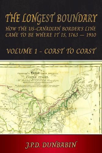
This is the only book to tell, in a way that should appeal to both specialised historians and the general reader, the story of how the course of what became the US-Canadian border was agreed, step by step, between 1763 and 1910, and to take in episodes, like the 1790 Nootka Sound crisis, that had major impacts but seldom figure in accounts of Anglo-American relations. Firmly based on primary documents, both published and unpublished, the book can often shed new light by using not only the more familiar American sources but also sometimes-overlooked British ones.
Often at odds with geography, the border's line might well have been different. Thus had an 1803 treaty been negotiated faster, it would have turned south at the Lake of the Woods not west along the 49th parallel, while in the 'War of 1812' the US sought to take 'Canada', Britain to make 'Michigan' an 'independent' Indian reserve. And adventitious factors could prove important: resolution of the long-running north-eastern boundary dispute was much helped by Daniel Webster's ability to pressure Maine's leaders by showing them recently acquired historic maps that seemed to bear out the British claim, while a similar British map implying the opposite did not surface until after the 1842 treaty. Had these maps come to light in a different order, compromise would have been far harder.
The book's chief actors are politicians and diplomats, but developments would be influenced by a range of others extending from First Nations chiefs and prophets to surveyors, sea captains, and ordinary people - from 1832-5 the tiny settlement of Indian Stream constituted itself an independent 'Republic', while in 1843 52 settlers in the Willamette Valley set up what proved a successful Provisional Government that ran Oregon until the US finally took over in 1849.
$9.00 standard shipping within Australia
FREE standard shipping within Australia for orders over $100.00
Express & International shipping calculated at checkout
This title is printed to order. This book may have been self-published. If so, we cannot guarantee the quality of the content. In the main most books will have gone through the editing process however some may not. We therefore suggest that you be aware of this before ordering this book. If in doubt check either the author or publisher’s details as we are unable to accept any returns unless they are faulty. Please contact us if you have any questions.
This is the only book to tell, in a way that should appeal to both specialised historians and the general reader, the story of how the course of what became the US-Canadian border was agreed, step by step, between 1763 and 1910, and to take in episodes, like the 1790 Nootka Sound crisis, that had major impacts but seldom figure in accounts of Anglo-American relations. Firmly based on primary documents, both published and unpublished, the book can often shed new light by using not only the more familiar American sources but also sometimes-overlooked British ones.
Often at odds with geography, the border's line might well have been different. Thus had an 1803 treaty been negotiated faster, it would have turned south at the Lake of the Woods not west along the 49th parallel, while in the 'War of 1812' the US sought to take 'Canada', Britain to make 'Michigan' an 'independent' Indian reserve. And adventitious factors could prove important: resolution of the long-running north-eastern boundary dispute was much helped by Daniel Webster's ability to pressure Maine's leaders by showing them recently acquired historic maps that seemed to bear out the British claim, while a similar British map implying the opposite did not surface until after the 1842 treaty. Had these maps come to light in a different order, compromise would have been far harder.
The book's chief actors are politicians and diplomats, but developments would be influenced by a range of others extending from First Nations chiefs and prophets to surveyors, sea captains, and ordinary people - from 1832-5 the tiny settlement of Indian Stream constituted itself an independent 'Republic', while in 1843 52 settlers in the Willamette Valley set up what proved a successful Provisional Government that ran Oregon until the US finally took over in 1849.
Search our extensive online catalogue.
