Readings Newsletter
Become a Readings Member to make your shopping experience even easier.
Sign in or sign up for free!
You’re not far away from qualifying for FREE standard shipping within Australia
You’ve qualified for FREE standard shipping within Australia
The cart is loading…


This title is printed to order. This book may have been self-published. If so, we cannot guarantee the quality of the content. In the main most books will have gone through the editing process however some may not. We therefore suggest that you be aware of this before ordering this book. If in doubt check either the author or publisher’s details as we are unable to accept any returns unless they are faulty. Please contact us if you have any questions.
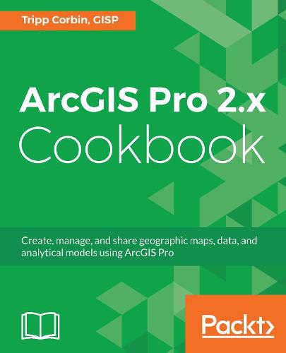
Creating and Sharing Maps and Data using ArcGIS Pro
Key Features
Leverage the power of ArcGIS to build beautiful 2D and 3D maps.
Work with ArcGIS to analyze and process data.
Extend the power of ArcGIS to ArcGIS Online to create and edit content.
Book DescriptionArcGIS is Esri’s catalog of GIS applications with powerful tools for visualizing, maintaining, and analyzing data. ArcGIS makes use of the modern ribbon interface and 64-bit processing to increase the speed and efficiency of using GIS. It allows users to create amazing maps in both 2D and 3D quickly and easily.
If you want to gain a thorough understanding of the various data formats that can be used in ArcGIS Pro and shared via ArcGIS Online, then this book is for you.
Beginning with a refresher on ArcGIS Pro and how to work with projects, this book will quickly take you through recipes about using various data formats supported by the tool. You will learn the limits of each format, such as Shapefiles, Geodatabase, and CAD files, and learn how to link tables from outside sources to existing GIS data to expand the amount of data that can be used in ArcGIS. You’ll learn methods for editing 2D and 3D data using ArcGIS Pro and how topology can be used to ensure data integrity. Lastly the book will show you how data and maps can be shared via ArcGIS Online and used with web and mobile applications.
What you will learn
Edit data using standard tools and topology Convert and link data together using joins and relates Create and share data using Projections and Coordinate Systems
Access and collect data in the field using ArcGIS Collector Perform proximity analysis and map clusters with hotspot analysis Use the 3D Analyst Extension and perform advanced 3D analysis Share maps and data using ArcGIS Online via web and mobile apps
Who this book is forGIS developers who are comfortable using ArcGIS, and are looking to increase their capabilities and skills, will find this book useful.
$9.00 standard shipping within Australia
FREE standard shipping within Australia for orders over $100.00
Express & International shipping calculated at checkout
This title is printed to order. This book may have been self-published. If so, we cannot guarantee the quality of the content. In the main most books will have gone through the editing process however some may not. We therefore suggest that you be aware of this before ordering this book. If in doubt check either the author or publisher’s details as we are unable to accept any returns unless they are faulty. Please contact us if you have any questions.
Creating and Sharing Maps and Data using ArcGIS Pro
Key Features
Leverage the power of ArcGIS to build beautiful 2D and 3D maps.
Work with ArcGIS to analyze and process data.
Extend the power of ArcGIS to ArcGIS Online to create and edit content.
Book DescriptionArcGIS is Esri’s catalog of GIS applications with powerful tools for visualizing, maintaining, and analyzing data. ArcGIS makes use of the modern ribbon interface and 64-bit processing to increase the speed and efficiency of using GIS. It allows users to create amazing maps in both 2D and 3D quickly and easily.
If you want to gain a thorough understanding of the various data formats that can be used in ArcGIS Pro and shared via ArcGIS Online, then this book is for you.
Beginning with a refresher on ArcGIS Pro and how to work with projects, this book will quickly take you through recipes about using various data formats supported by the tool. You will learn the limits of each format, such as Shapefiles, Geodatabase, and CAD files, and learn how to link tables from outside sources to existing GIS data to expand the amount of data that can be used in ArcGIS. You’ll learn methods for editing 2D and 3D data using ArcGIS Pro and how topology can be used to ensure data integrity. Lastly the book will show you how data and maps can be shared via ArcGIS Online and used with web and mobile applications.
What you will learn
Edit data using standard tools and topology Convert and link data together using joins and relates Create and share data using Projections and Coordinate Systems
Access and collect data in the field using ArcGIS Collector Perform proximity analysis and map clusters with hotspot analysis Use the 3D Analyst Extension and perform advanced 3D analysis Share maps and data using ArcGIS Online via web and mobile apps
Who this book is forGIS developers who are comfortable using ArcGIS, and are looking to increase their capabilities and skills, will find this book useful.