Readings Newsletter
Become a Readings Member to make your shopping experience even easier.
Sign in or sign up for free!
You’re not far away from qualifying for FREE standard shipping within Australia
You’ve qualified for FREE standard shipping within Australia
The cart is loading…


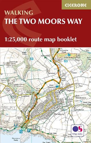
All the mapping you need to complete the Two Moors Way, Devon’s coast to coast route between Wembury Bay and Lynmouth, including a section of the Erme-Plym Trail.
NOTE: An accompanying Cicerone guidebook - The Two Moors Way - describes the route south to north, with summary directions for walking north to south. It includes lots of other practical information and background notes on points of interest along the route, for those who prefer a written guide. The accompanying guidebook INCLUDES a copy of this map booklet.
This booklet of Ordnance Survey 1:25,000 Explorer maps has been designed for convenient use on the trail. It shows the full and up-to-date line of the Two Moors Way, along with the relevant extract from the OS Explorer map legend. It is conveniently sized for slipping into a jacket pocket or top of a rucksack and comes in a clear PVC sleeve.
$9.00 standard shipping within Australia
FREE standard shipping within Australia for orders over $100.00
Express & International shipping calculated at checkout
All the mapping you need to complete the Two Moors Way, Devon’s coast to coast route between Wembury Bay and Lynmouth, including a section of the Erme-Plym Trail.
NOTE: An accompanying Cicerone guidebook - The Two Moors Way - describes the route south to north, with summary directions for walking north to south. It includes lots of other practical information and background notes on points of interest along the route, for those who prefer a written guide. The accompanying guidebook INCLUDES a copy of this map booklet.
This booklet of Ordnance Survey 1:25,000 Explorer maps has been designed for convenient use on the trail. It shows the full and up-to-date line of the Two Moors Way, along with the relevant extract from the OS Explorer map legend. It is conveniently sized for slipping into a jacket pocket or top of a rucksack and comes in a clear PVC sleeve.
Search our extensive online catalogue.
