Readings Newsletter
Become a Readings Member to make your shopping experience even easier.
Sign in or sign up for free!
You’re not far away from qualifying for FREE standard shipping within Australia
You’ve qualified for FREE standard shipping within Australia
The cart is loading…


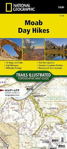
Waterproof Tear-Resistant Topographic Map.
From Jurassic-era dunes and prehistoric petroglyphs, to amber-tinted cliffs and spires, Moab offers a plethora of options for every type of traveler. The Moab Day Hikes Topographic Map Guide covers a large are of north east Utah including two National Parks; Canyonland and Arches, as well as Dead Horse Point State Park, Manti-La Sal National Forest, and large areas of BLM land.
Moab Day Hikes contains detailed maps for 18 of Moab's finest day hikes. It includes well-known hikes and some off-the-beaten-path trails. They range from easy strolls to strenuous climbs, selected to give you a sampling of all the region has to offer. Together, they cover more than 70 miles of adventures. Two-thirds of the selected hikes are less than 5 miles long and one hike is 8 miles long.
Each of the 18 maps include directions to the trailhead, the total distance to complete the hike, and an estimate of the degree of difficulty. Also provided are elevations of key points on the trail, an elevation profile for the hike, and a calculation of the hike's total elevation gain. Concise trail descriptions will help you find the hikes that best suit your interests, conditioning, and available time.
Every Trails Illustrated map is printed on "Backcountry Tough" waterproof, tear-resistant paper. A full UTM grid is printed on the map to aid with GPS navigation. Every map purchase helps support the National Geographic Society, an impact driven, nonprofit organization with global reach that uses the power of science, exploration, education, and storytelling to illuminate and protect the wonder of our world.
$9.00 standard shipping within Australia
FREE standard shipping within Australia for orders over $100.00
Express & International shipping calculated at checkout
Waterproof Tear-Resistant Topographic Map.
From Jurassic-era dunes and prehistoric petroglyphs, to amber-tinted cliffs and spires, Moab offers a plethora of options for every type of traveler. The Moab Day Hikes Topographic Map Guide covers a large are of north east Utah including two National Parks; Canyonland and Arches, as well as Dead Horse Point State Park, Manti-La Sal National Forest, and large areas of BLM land.
Moab Day Hikes contains detailed maps for 18 of Moab's finest day hikes. It includes well-known hikes and some off-the-beaten-path trails. They range from easy strolls to strenuous climbs, selected to give you a sampling of all the region has to offer. Together, they cover more than 70 miles of adventures. Two-thirds of the selected hikes are less than 5 miles long and one hike is 8 miles long.
Each of the 18 maps include directions to the trailhead, the total distance to complete the hike, and an estimate of the degree of difficulty. Also provided are elevations of key points on the trail, an elevation profile for the hike, and a calculation of the hike's total elevation gain. Concise trail descriptions will help you find the hikes that best suit your interests, conditioning, and available time.
Every Trails Illustrated map is printed on "Backcountry Tough" waterproof, tear-resistant paper. A full UTM grid is printed on the map to aid with GPS navigation. Every map purchase helps support the National Geographic Society, an impact driven, nonprofit organization with global reach that uses the power of science, exploration, education, and storytelling to illuminate and protect the wonder of our world.
Search our extensive online catalogue.
