Readings Newsletter
Become a Readings Member to make your shopping experience even easier.
Sign in or sign up for free!
You’re not far away from qualifying for FREE standard shipping within Australia
You’ve qualified for FREE standard shipping within Australia
The cart is loading…


Waterproof Tear-Resistant Topographic Maps
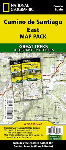
The Way of Saint James, known in Spanish as Camino de Santiago - or simply El Camino (The Way) - has been one of Europe's most iconic walking routes since 9th century pilgrims began making their way to the Cathedral of Santiago de Compostela to venerate the remains of Saint James. Though rooted in Christian tradition, the route has been reborn as a nondenominational spiritual rite and epic long distance trail that runs along Roman roads, across mountains, and through picturesque countryside and historic towns.
Each Camino de Santiago Topographic Map Guide includes detailed topographic maps of 2 cm = 1 km. Each page is centered on the trail and overlaps with the adjacent pages so there is little chance of getting lost. Along the bottom of each page is a trail profile that shows the distance between towns, rest houses, and trail access points. The map and trail profile provide a step by step visual guide to hiking the trail.
The Map Pack Bundle contains two maps and covers the eastern Camino Frances (French Way) from Saint-Jean-Pied-de-Port in France to Terradillos de los Templarios.
The Camino de Santiago East Map Pack includes;
-4002 :: Camino de Santiago 1 of 4 [Saint-Jean-Pied-de-Port to Santo Domingo de la Calzada]
-4003 :: Camino de Santiago 2 of 4 [Santo Domingo de la Calzada to Terradillos de los Templarios]
Every Great Treks map is printed on "Backcountry Tough" waterproof, tear-resistant paper. A full Lat/Long grid is printed on the map to aid with GPS navigation.
$9.00 standard shipping within Australia
FREE standard shipping within Australia for orders over $100.00
Express & International shipping calculated at checkout
Waterproof Tear-Resistant Topographic Maps
The Way of Saint James, known in Spanish as Camino de Santiago - or simply El Camino (The Way) - has been one of Europe's most iconic walking routes since 9th century pilgrims began making their way to the Cathedral of Santiago de Compostela to venerate the remains of Saint James. Though rooted in Christian tradition, the route has been reborn as a nondenominational spiritual rite and epic long distance trail that runs along Roman roads, across mountains, and through picturesque countryside and historic towns.
Each Camino de Santiago Topographic Map Guide includes detailed topographic maps of 2 cm = 1 km. Each page is centered on the trail and overlaps with the adjacent pages so there is little chance of getting lost. Along the bottom of each page is a trail profile that shows the distance between towns, rest houses, and trail access points. The map and trail profile provide a step by step visual guide to hiking the trail.
The Map Pack Bundle contains two maps and covers the eastern Camino Frances (French Way) from Saint-Jean-Pied-de-Port in France to Terradillos de los Templarios.
The Camino de Santiago East Map Pack includes;
-4002 :: Camino de Santiago 1 of 4 [Saint-Jean-Pied-de-Port to Santo Domingo de la Calzada]
-4003 :: Camino de Santiago 2 of 4 [Santo Domingo de la Calzada to Terradillos de los Templarios]
Every Great Treks map is printed on "Backcountry Tough" waterproof, tear-resistant paper. A full Lat/Long grid is printed on the map to aid with GPS navigation.
Search our extensive online catalogue.
