Readings Newsletter
Become a Readings Member to make your shopping experience even easier.
Sign in or sign up for free!
You’re not far away from qualifying for FREE standard shipping within Australia
You’ve qualified for FREE standard shipping within Australia
The cart is loading…


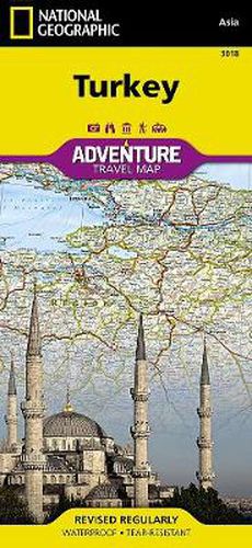
National Geographic’s Turkey Adventure Map is designed to meet the unique needs of adventure travelers with its durability and accurate information. This folded map provides global travelers with the perfect combination of detail and perspective, highlighting hundreds of points of interest and the diverse and unique destinations within the country. The front side of the Turkey map details the eastern region of the country, from its border with Syria and Iraq to the south, Iran and Armenia to the East, extending to the Black Sea and Georgia to the north. The regions featured on this side are Southeast Anatolia and East Anatolia. The reverse side of the map details Turkey’s western portion of the country, from its border with Greece to the west, to the Mediterranean Sea to the south, extending to the Black Sea to the north. This side covers the Black Sea Region, Aegean Region, Central Anatolia Region and the Mediterranean Region. The map includes the locations of cities and towns with a user-friendly index, plus a clearly marked road network complete with distances and designations for major highways, main roads, and tracks and trails for those seeking to explore more remote regions. Every Adventure Map is printed on durable synthetic paper, making them waterproof, tear-resistant and tough - capable of withstanding the rigors of international travel. Each is two-sided and can be folded to a packable size of 235 x 108 mm; unfolded size is 965 x 660 mm.
$9.00 standard shipping within Australia
FREE standard shipping within Australia for orders over $100.00
Express & International shipping calculated at checkout
National Geographic’s Turkey Adventure Map is designed to meet the unique needs of adventure travelers with its durability and accurate information. This folded map provides global travelers with the perfect combination of detail and perspective, highlighting hundreds of points of interest and the diverse and unique destinations within the country. The front side of the Turkey map details the eastern region of the country, from its border with Syria and Iraq to the south, Iran and Armenia to the East, extending to the Black Sea and Georgia to the north. The regions featured on this side are Southeast Anatolia and East Anatolia. The reverse side of the map details Turkey’s western portion of the country, from its border with Greece to the west, to the Mediterranean Sea to the south, extending to the Black Sea to the north. This side covers the Black Sea Region, Aegean Region, Central Anatolia Region and the Mediterranean Region. The map includes the locations of cities and towns with a user-friendly index, plus a clearly marked road network complete with distances and designations for major highways, main roads, and tracks and trails for those seeking to explore more remote regions. Every Adventure Map is printed on durable synthetic paper, making them waterproof, tear-resistant and tough - capable of withstanding the rigors of international travel. Each is two-sided and can be folded to a packable size of 235 x 108 mm; unfolded size is 965 x 660 mm.
Search our extensive online catalogue.
