Readings Newsletter
Become a Readings Member to make your shopping experience even easier.
Sign in or sign up for free!
You’re not far away from qualifying for FREE standard shipping within Australia
You’ve qualified for FREE standard shipping within Australia
The cart is loading…


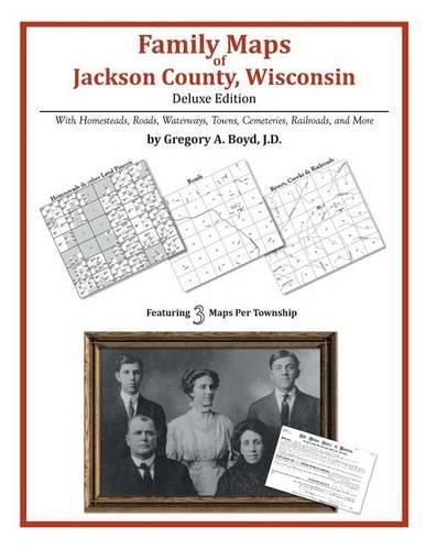
402 pages with 92 total maps Locating original landowners in maps has never been an easy task-until now. This volume in the Family Maps series contains newly created maps of original landowners (patent maps) in what is now Jackson County, Wisconsin, gleaned from the indexes of the U.S. Bureau of Land Management. But it offers much more than that. For each township in the county, there are two additional maps accompanying the patent map: a road map and a map showing waterways, railroads, and both modern and many historical city-centers and cemeteries. Included are indexes to help you locate what you are looking for, whether you know a person’s name, a last name, a place-name, or a cemetery. The combination of maps and indexes are designed to aid researchers of American history or genealogy to explore frontier neighborhoods, examine family migrations, locate hard-to-find cemeteries and towns, as well as locate land based on legal descriptions found in old documents or deeds. The patent-maps are essentially plat maps but instead of depicting owners for a particular year, these maps show original landowners, no matter when the transfer from the federal government was completed. Dates of patents typically begin near the time of statehood and run into the early 1900s. What’s Mapped in this book (that you’ll not likely find elsewhere) … 5714 Parcels of Land (with original landowner names and patent-dates labeled in the relevant map) 43 Cemeteries plus … Roads, and existing Rivers, Creeks, Streams, Railroads, and Small-towns (including some historical), etc. What YEARS are these maps for? Here are the counts for parcels of land mapped, by the decade in which the corresponding land patents were issued: Decade Parcel-count 1840s 1 1850s 2475 1860s 943 1870s 838 1880s 603 1890s 336 1900s 288 1910s 86 1920s 20 1930s 2 1940s 34 1950s 79 1960s 2 1980s 1 1990s 3 2000s 1 What Cities and Towns are in Jackson County, Wisconsin (and in this book)? Alma Center, Black River Falls, Brockway, Charter Oak Mills (historical), City Point, Disco, Fall Hall Glen, Franklin, Hatfield, Hixton, Irving, Lapham Junction, Levis, Melrose, Merrillan, Millston, North Bend, North Branch, Northfield, Pray, Price, Requa, Rogneys (historical), Sechlerville, Shamrock, Sheppard, Spaulding, Speck Oaks, Taylor, Vaudreuil, Waterbury, Winnebago Mission, York
$9.00 standard shipping within Australia
FREE standard shipping within Australia for orders over $100.00
Express & International shipping calculated at checkout
402 pages with 92 total maps Locating original landowners in maps has never been an easy task-until now. This volume in the Family Maps series contains newly created maps of original landowners (patent maps) in what is now Jackson County, Wisconsin, gleaned from the indexes of the U.S. Bureau of Land Management. But it offers much more than that. For each township in the county, there are two additional maps accompanying the patent map: a road map and a map showing waterways, railroads, and both modern and many historical city-centers and cemeteries. Included are indexes to help you locate what you are looking for, whether you know a person’s name, a last name, a place-name, or a cemetery. The combination of maps and indexes are designed to aid researchers of American history or genealogy to explore frontier neighborhoods, examine family migrations, locate hard-to-find cemeteries and towns, as well as locate land based on legal descriptions found in old documents or deeds. The patent-maps are essentially plat maps but instead of depicting owners for a particular year, these maps show original landowners, no matter when the transfer from the federal government was completed. Dates of patents typically begin near the time of statehood and run into the early 1900s. What’s Mapped in this book (that you’ll not likely find elsewhere) … 5714 Parcels of Land (with original landowner names and patent-dates labeled in the relevant map) 43 Cemeteries plus … Roads, and existing Rivers, Creeks, Streams, Railroads, and Small-towns (including some historical), etc. What YEARS are these maps for? Here are the counts for parcels of land mapped, by the decade in which the corresponding land patents were issued: Decade Parcel-count 1840s 1 1850s 2475 1860s 943 1870s 838 1880s 603 1890s 336 1900s 288 1910s 86 1920s 20 1930s 2 1940s 34 1950s 79 1960s 2 1980s 1 1990s 3 2000s 1 What Cities and Towns are in Jackson County, Wisconsin (and in this book)? Alma Center, Black River Falls, Brockway, Charter Oak Mills (historical), City Point, Disco, Fall Hall Glen, Franklin, Hatfield, Hixton, Irving, Lapham Junction, Levis, Melrose, Merrillan, Millston, North Bend, North Branch, Northfield, Pray, Price, Requa, Rogneys (historical), Sechlerville, Shamrock, Sheppard, Spaulding, Speck Oaks, Taylor, Vaudreuil, Waterbury, Winnebago Mission, York
Search our extensive online catalogue.
