Readings Newsletter
Become a Readings Member to make your shopping experience even easier.
Sign in or sign up for free!
You’re not far away from qualifying for FREE standard shipping within Australia
You’ve qualified for FREE standard shipping within Australia
The cart is loading…


This title is printed to order. This book may have been self-published. If so, we cannot guarantee the quality of the content. In the main most books will have gone through the editing process however some may not. We therefore suggest that you be aware of this before ordering this book. If in doubt check either the author or publisher’s details as we are unable to accept any returns unless they are faulty. Please contact us if you have any questions.
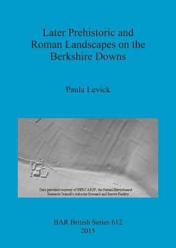
The aim of this work was to examine land-use and settlement on the Berkshire Downs from the Bronze Age to the end of the Romano-British period. Earlier research in this region had presented a landscape history that was in contrast to elsewhere on the Wessex chalklands and rather than a land that grew organically over 2.5 millennia, the area is seen as one which was sporadically occupied, worked, and possibly abandoned. In the west of the region late Bronze Age linear ditches mark a major reorganization in the scale of the landscape, but only a small number of contemporary settlements are known, and field systems appear to be absent. This is followed by an apparent hiatus until the establishment of organised farming communities in the Romano-British period engaged in large-scale cereal production. In the east, Segsbury Camp is seen to signal the emergence of early Iron Age occupation into an area of previously unoccupied and unused land, with later settlement on the Downs continuing into the late Iron Age. Beyond this period little is known and the fragmentary field systems in this region remain undated. It is proposed that these interpretations are illusory, created by large-scale Romano-British arable expansion in the west masking earlier occupation, and post Roman land-use in the east destroying upstanding monuments and creating a bias in our interpretation. Today, these former landscapes, some of which survived into the 20th century, are mostly plough-levelled. As such, further understanding lies beyond the limit of many conventional fieldwork methods. A multi-disciplinary approach was used to rebuild this landscape. Aerial transcription from the National Mapping Programme is used to provide a view of the landscape before its destruction through modern agriculture, while maps and documents, lidar, woodland survey, geophysics and metal detected finds are used to create a theoretical account of activity across this region.
$9.00 standard shipping within Australia
FREE standard shipping within Australia for orders over $100.00
Express & International shipping calculated at checkout
This title is printed to order. This book may have been self-published. If so, we cannot guarantee the quality of the content. In the main most books will have gone through the editing process however some may not. We therefore suggest that you be aware of this before ordering this book. If in doubt check either the author or publisher’s details as we are unable to accept any returns unless they are faulty. Please contact us if you have any questions.
The aim of this work was to examine land-use and settlement on the Berkshire Downs from the Bronze Age to the end of the Romano-British period. Earlier research in this region had presented a landscape history that was in contrast to elsewhere on the Wessex chalklands and rather than a land that grew organically over 2.5 millennia, the area is seen as one which was sporadically occupied, worked, and possibly abandoned. In the west of the region late Bronze Age linear ditches mark a major reorganization in the scale of the landscape, but only a small number of contemporary settlements are known, and field systems appear to be absent. This is followed by an apparent hiatus until the establishment of organised farming communities in the Romano-British period engaged in large-scale cereal production. In the east, Segsbury Camp is seen to signal the emergence of early Iron Age occupation into an area of previously unoccupied and unused land, with later settlement on the Downs continuing into the late Iron Age. Beyond this period little is known and the fragmentary field systems in this region remain undated. It is proposed that these interpretations are illusory, created by large-scale Romano-British arable expansion in the west masking earlier occupation, and post Roman land-use in the east destroying upstanding monuments and creating a bias in our interpretation. Today, these former landscapes, some of which survived into the 20th century, are mostly plough-levelled. As such, further understanding lies beyond the limit of many conventional fieldwork methods. A multi-disciplinary approach was used to rebuild this landscape. Aerial transcription from the National Mapping Programme is used to provide a view of the landscape before its destruction through modern agriculture, while maps and documents, lidar, woodland survey, geophysics and metal detected finds are used to create a theoretical account of activity across this region.
Search our extensive online catalogue.
