Readings Newsletter
Become a Readings Member to make your shopping experience even easier.
Sign in or sign up for free!
You’re not far away from qualifying for FREE standard shipping within Australia
You’ve qualified for FREE standard shipping within Australia
The cart is loading…


This title is printed to order. This book may have been self-published. If so, we cannot guarantee the quality of the content. In the main most books will have gone through the editing process however some may not. We therefore suggest that you be aware of this before ordering this book. If in doubt check either the author or publisher’s details as we are unable to accept any returns unless they are faulty. Please contact us if you have any questions.
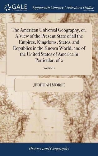
The 18th century was a wealth of knowledge, exploration and rapidly growing technology and expanding record-keeping made possible by advances in the printing press. In its determination to preserve the century of revolution, Gale initiated a revolution of its own: digitization of epic proportions to preserve these invaluable works in the largest archive of its kind. Now for the first time these high-quality digital copies of original 18th century manuscripts are available in print, making them highly accessible to libraries, undergraduate students, and independent scholars. Rich in titles on English life and social history, this collection spans the world as it was known to eighteenth-century historians and explorers. Titles include a wealth of travel accounts and diaries, histories of nations from throughout the world, and maps and charts of a world that was still being discovered. Students of the War of American Independence will find fascinating accounts from the British side of conflict. ++++ The below data was compiled from various identification fields in the bibliographic record of this title. This data is provided as an additional tool in helping to insure edition identification: ++++ Library of Congress
W031208
Part I is "a new edition of the American geography, corrected and enlarged." - Plates engraved by Amos Doolittle and Joel Knott Allen. Maps of Maine and Pennsylvania drawn by Osgood Carleton; map of the southern states by Joseph Purcell. Imprint of v. 2 varies: Printed at Boston, by Young and Etheridge, for the author and Thomas and Andrews. .. Vol. 1: [13], 18-696 p., [8] leaves of plates (7 folded); v. 2: [4], 520, (521)-(528), 521-552 p., [3] folded leaves of plates. Errors in paging: v. 1, p. 143 misnumbered 134; v. 2, p. 287, 458 misnumbered 187, 558.
Printed at Boston: by Isaiah Thomas and Ebenezer T. Andrews. Sold at their bookstore, Faust's Statue, no. 45, Newbury Street; by said Thomas, in Worcester; by Berry, Rogers and Berry, in Newyork; by H. and P. Rice, in Philadelphia; and by W.P. Young, in Charleston, MDCCXCIII. [1793]. 2v.: ill., maps; 8 degrees
$9.00 standard shipping within Australia
FREE standard shipping within Australia for orders over $100.00
Express & International shipping calculated at checkout
This title is printed to order. This book may have been self-published. If so, we cannot guarantee the quality of the content. In the main most books will have gone through the editing process however some may not. We therefore suggest that you be aware of this before ordering this book. If in doubt check either the author or publisher’s details as we are unable to accept any returns unless they are faulty. Please contact us if you have any questions.
The 18th century was a wealth of knowledge, exploration and rapidly growing technology and expanding record-keeping made possible by advances in the printing press. In its determination to preserve the century of revolution, Gale initiated a revolution of its own: digitization of epic proportions to preserve these invaluable works in the largest archive of its kind. Now for the first time these high-quality digital copies of original 18th century manuscripts are available in print, making them highly accessible to libraries, undergraduate students, and independent scholars. Rich in titles on English life and social history, this collection spans the world as it was known to eighteenth-century historians and explorers. Titles include a wealth of travel accounts and diaries, histories of nations from throughout the world, and maps and charts of a world that was still being discovered. Students of the War of American Independence will find fascinating accounts from the British side of conflict. ++++ The below data was compiled from various identification fields in the bibliographic record of this title. This data is provided as an additional tool in helping to insure edition identification: ++++ Library of Congress
W031208
Part I is "a new edition of the American geography, corrected and enlarged." - Plates engraved by Amos Doolittle and Joel Knott Allen. Maps of Maine and Pennsylvania drawn by Osgood Carleton; map of the southern states by Joseph Purcell. Imprint of v. 2 varies: Printed at Boston, by Young and Etheridge, for the author and Thomas and Andrews. .. Vol. 1: [13], 18-696 p., [8] leaves of plates (7 folded); v. 2: [4], 520, (521)-(528), 521-552 p., [3] folded leaves of plates. Errors in paging: v. 1, p. 143 misnumbered 134; v. 2, p. 287, 458 misnumbered 187, 558.
Printed at Boston: by Isaiah Thomas and Ebenezer T. Andrews. Sold at their bookstore, Faust's Statue, no. 45, Newbury Street; by said Thomas, in Worcester; by Berry, Rogers and Berry, in Newyork; by H. and P. Rice, in Philadelphia; and by W.P. Young, in Charleston, MDCCXCIII. [1793]. 2v.: ill., maps; 8 degrees