Readings Newsletter
Become a Readings Member to make your shopping experience even easier.
Sign in or sign up for free!
You’re not far away from qualifying for FREE standard shipping within Australia
You’ve qualified for FREE standard shipping within Australia
The cart is loading…


This title is printed to order. This book may have been self-published. If so, we cannot guarantee the quality of the content. In the main most books will have gone through the editing process however some may not. We therefore suggest that you be aware of this before ordering this book. If in doubt check either the author or publisher’s details as we are unable to accept any returns unless they are faulty. Please contact us if you have any questions.
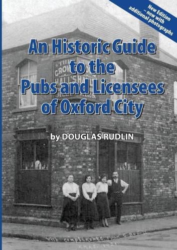
This newly revised version contains over 90 photographs of the pubs of Oxford that were still open for business in the early 1960s. These came to light in November 2024 and were rescued from going in a skip. They give a good idea of what the pub scene was like in Oxford sixty years ago. This book is also an excellent reference book for Family History researchers as well as those interested in the history of the pubs themselves. In 1883 a map was published, entitled 'Drink Map of Oxford' which showed the locations of all licensed premises in Victorian Oxford. This was not a map intended to guide drinkers to places to sample or buy alcohol however - this was produced by the Temperance Movement and its purpose was to show that licensed premises were most densely located in the poorer areas of the city. The accompanying text on the reverse of the map begins by stating: "The Drink Map of Oxford makes bare the fact that few, if any, other towns in the kingdom are so liberally supplied with houses for the sale of intoxicants as this ancient city." On seeing the second edition of the map (published by the Bodleian Library in 2019), author Douglas Rudlin was inspired to write this guide in an attempt to give a name and address (both old and current) to each licensed premises as none of the locations marked on the map are identified. Out of 268 'Full Licensed Houses' and 'Beer Houses' Douglas has identified 246 and many entries include the first historic reference to the premises, changes in name, details of their sale/purchase, and a list of many of the recorded licensees up to around 1939 (often including other profession, with spouse and family information if known). Details on whether the premises was demolished, redeveloped (and what stands on that location today) or if it still exists as a pub also appears.
$9.00 standard shipping within Australia
FREE standard shipping within Australia for orders over $100.00
Express & International shipping calculated at checkout
This title is printed to order. This book may have been self-published. If so, we cannot guarantee the quality of the content. In the main most books will have gone through the editing process however some may not. We therefore suggest that you be aware of this before ordering this book. If in doubt check either the author or publisher’s details as we are unable to accept any returns unless they are faulty. Please contact us if you have any questions.
This newly revised version contains over 90 photographs of the pubs of Oxford that were still open for business in the early 1960s. These came to light in November 2024 and were rescued from going in a skip. They give a good idea of what the pub scene was like in Oxford sixty years ago. This book is also an excellent reference book for Family History researchers as well as those interested in the history of the pubs themselves. In 1883 a map was published, entitled 'Drink Map of Oxford' which showed the locations of all licensed premises in Victorian Oxford. This was not a map intended to guide drinkers to places to sample or buy alcohol however - this was produced by the Temperance Movement and its purpose was to show that licensed premises were most densely located in the poorer areas of the city. The accompanying text on the reverse of the map begins by stating: "The Drink Map of Oxford makes bare the fact that few, if any, other towns in the kingdom are so liberally supplied with houses for the sale of intoxicants as this ancient city." On seeing the second edition of the map (published by the Bodleian Library in 2019), author Douglas Rudlin was inspired to write this guide in an attempt to give a name and address (both old and current) to each licensed premises as none of the locations marked on the map are identified. Out of 268 'Full Licensed Houses' and 'Beer Houses' Douglas has identified 246 and many entries include the first historic reference to the premises, changes in name, details of their sale/purchase, and a list of many of the recorded licensees up to around 1939 (often including other profession, with spouse and family information if known). Details on whether the premises was demolished, redeveloped (and what stands on that location today) or if it still exists as a pub also appears.
Search our extensive online catalogue.
