Readings Newsletter
Become a Readings Member to make your shopping experience even easier.
Sign in or sign up for free!
You’re not far away from qualifying for FREE standard shipping within Australia
You’ve qualified for FREE standard shipping within Australia
The cart is loading…


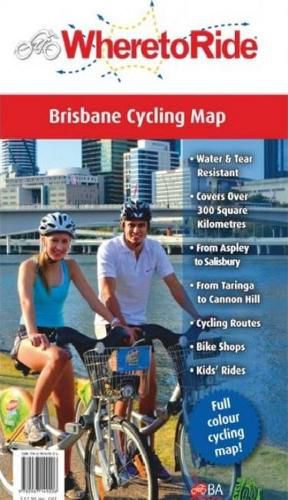
When unfolded, it reveals a detailed, full colour map, printed on both sides that covers over 300 square kilometres of central Brisbane, stretching from Aspley to Salisbury, and from Taringa to Cannon Hill.
In this unrivalled cycling map, all of the roads and freeways have been faded to grey, then four layers of colour coded cycling routes have been accurately overlaid. The first, in red, shows the rides from our popular Where to Ride South East Queensland guidebook. Next, in yellow, are off road cycle paths. On road cycling lanes are in dashed blue. Last, but certainly not least, in dotted green are the myriad of informal cycling routes. These may not be on any ‘official’ maps, but for real world cyclists they are the best routes to avoid the traffic or to take short cuts. You’ll also see a set of symbols to pinpoint every bike shop, kids cycle area and more.
iPhones and Garmins are clever devices, but to see such a broad expanse of Brisbane in minute detail, with every cycling feature so clearly highlighted, nothing comes close to our Where to Ride Brisbane Cycling Map. It’s the perfect companion for all cyclists!
$9.00 standard shipping within Australia
FREE standard shipping within Australia for orders over $100.00
Express & International shipping calculated at checkout
When unfolded, it reveals a detailed, full colour map, printed on both sides that covers over 300 square kilometres of central Brisbane, stretching from Aspley to Salisbury, and from Taringa to Cannon Hill.
In this unrivalled cycling map, all of the roads and freeways have been faded to grey, then four layers of colour coded cycling routes have been accurately overlaid. The first, in red, shows the rides from our popular Where to Ride South East Queensland guidebook. Next, in yellow, are off road cycle paths. On road cycling lanes are in dashed blue. Last, but certainly not least, in dotted green are the myriad of informal cycling routes. These may not be on any ‘official’ maps, but for real world cyclists they are the best routes to avoid the traffic or to take short cuts. You’ll also see a set of symbols to pinpoint every bike shop, kids cycle area and more.
iPhones and Garmins are clever devices, but to see such a broad expanse of Brisbane in minute detail, with every cycling feature so clearly highlighted, nothing comes close to our Where to Ride Brisbane Cycling Map. It’s the perfect companion for all cyclists!
Search our extensive online catalogue.
