Readings Newsletter
Become a Readings Member to make your shopping experience even easier.
Sign in or sign up for free!
You’re not far away from qualifying for FREE standard shipping within Australia
You’ve qualified for FREE standard shipping within Australia
The cart is loading…


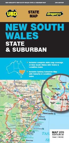
The latest edition of the New South Wales state and suburban map has been fully revised and updated.
It includes state mapping at a scale of 1: 1 600 000 plus an index to towns and localities on one side and on the other side there is Sydney and surrounds suburban coverage north to Gosford, south to Douglas Park and Stanwell Park, along the coast from Palm Beach to Coalcliff and west to Springwood plus an index to the suburbs and localities included on this map.
With all this information contained in this handy fold up map this is an essential tool when travelling around New South Wales and the Sydney region.
$9.00 standard shipping within Australia
FREE standard shipping within Australia for orders over $100.00
Express & International shipping calculated at checkout
The latest edition of the New South Wales state and suburban map has been fully revised and updated.
It includes state mapping at a scale of 1: 1 600 000 plus an index to towns and localities on one side and on the other side there is Sydney and surrounds suburban coverage north to Gosford, south to Douglas Park and Stanwell Park, along the coast from Palm Beach to Coalcliff and west to Springwood plus an index to the suburbs and localities included on this map.
With all this information contained in this handy fold up map this is an essential tool when travelling around New South Wales and the Sydney region.
Search our extensive online catalogue.
