Readings Newsletter
Become a Readings Member to make your shopping experience even easier.
Sign in or sign up for free!
You’re not far away from qualifying for FREE standard shipping within Australia
You’ve qualified for FREE standard shipping within Australia
The cart is loading…


This title is printed to order. This book may have been self-published. If so, we cannot guarantee the quality of the content. In the main most books will have gone through the editing process however some may not. We therefore suggest that you be aware of this before ordering this book. If in doubt check either the author or publisher’s details as we are unable to accept any returns unless they are faulty. Please contact us if you have any questions.
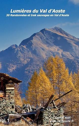
Noel Crosetti nous propose ici un topo de 30 itineraires peu connus de randonnee pedestre dans le Val d'Aoste. Chaque excursion est decrite par une fiche technique, un croquis avec une carte topographique, et un texte detaille relatif a l'itineraire. Des QR-codes agrementent les itineraires et renvoient aux traces Gps telechargeables et a des videos relatant la randonnee. Le niveau des difficultes s'etend des randonnees faciles, aux excursions plus engagees necessitant une certaine experience de la montagne.
$9.00 standard shipping within Australia
FREE standard shipping within Australia for orders over $100.00
Express & International shipping calculated at checkout
This title is printed to order. This book may have been self-published. If so, we cannot guarantee the quality of the content. In the main most books will have gone through the editing process however some may not. We therefore suggest that you be aware of this before ordering this book. If in doubt check either the author or publisher’s details as we are unable to accept any returns unless they are faulty. Please contact us if you have any questions.
Noel Crosetti nous propose ici un topo de 30 itineraires peu connus de randonnee pedestre dans le Val d'Aoste. Chaque excursion est decrite par une fiche technique, un croquis avec une carte topographique, et un texte detaille relatif a l'itineraire. Des QR-codes agrementent les itineraires et renvoient aux traces Gps telechargeables et a des videos relatant la randonnee. Le niveau des difficultes s'etend des randonnees faciles, aux excursions plus engagees necessitant une certaine experience de la montagne.
Search our extensive online catalogue.
