Readings Newsletter
Become a Readings Member to make your shopping experience even easier.
Sign in or sign up for free!
You’re not far away from qualifying for FREE standard shipping within Australia
You’ve qualified for FREE standard shipping within Australia
The cart is loading…


This title is printed to order. This book may have been self-published. If so, we cannot guarantee the quality of the content. In the main most books will have gone through the editing process however some may not. We therefore suggest that you be aware of this before ordering this book. If in doubt check either the author or publisher’s details as we are unable to accept any returns unless they are faulty. Please contact us if you have any questions.
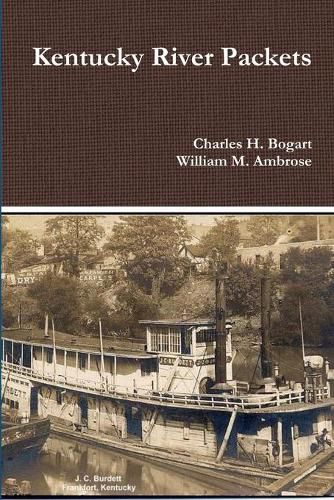
The Kentucky River is formed in eastern Kentucky at Beattyville, where the North, Middle and South Forks join together. The river then flows 260 miles to the Ohio River at Carrolton. The river drains much of the central region of the state. With the appearance of the early steamboats on the Kentucky River in the 1820s, the river became the primary artery for economic growth with trade with the lower south. This dominance lasted until the Civil War when the railroads surpassed the packetboats with freight traffic. After the war, river traffic shifted to towboats pushing barges of bulk commodities. However, steam packetboats, and later gasboats, continued to service the isolated river communities along the lower river until the Great Depression. In 1836-1842, the Commonwealth of Kentucky constructed five locks and dams, from Carrollton to Tyrone. These dams created pools of water which allowed year round "slackwater" navigation. The state operated these locks until after the Civil War.
$9.00 standard shipping within Australia
FREE standard shipping within Australia for orders over $100.00
Express & International shipping calculated at checkout
This title is printed to order. This book may have been self-published. If so, we cannot guarantee the quality of the content. In the main most books will have gone through the editing process however some may not. We therefore suggest that you be aware of this before ordering this book. If in doubt check either the author or publisher’s details as we are unable to accept any returns unless they are faulty. Please contact us if you have any questions.
The Kentucky River is formed in eastern Kentucky at Beattyville, where the North, Middle and South Forks join together. The river then flows 260 miles to the Ohio River at Carrolton. The river drains much of the central region of the state. With the appearance of the early steamboats on the Kentucky River in the 1820s, the river became the primary artery for economic growth with trade with the lower south. This dominance lasted until the Civil War when the railroads surpassed the packetboats with freight traffic. After the war, river traffic shifted to towboats pushing barges of bulk commodities. However, steam packetboats, and later gasboats, continued to service the isolated river communities along the lower river until the Great Depression. In 1836-1842, the Commonwealth of Kentucky constructed five locks and dams, from Carrollton to Tyrone. These dams created pools of water which allowed year round "slackwater" navigation. The state operated these locks until after the Civil War.
Search our extensive online catalogue.
