Readings Newsletter
Become a Readings Member to make your shopping experience even easier.
Sign in or sign up for free!
You’re not far away from qualifying for FREE standard shipping within Australia
You’ve qualified for FREE standard shipping within Australia
The cart is loading…


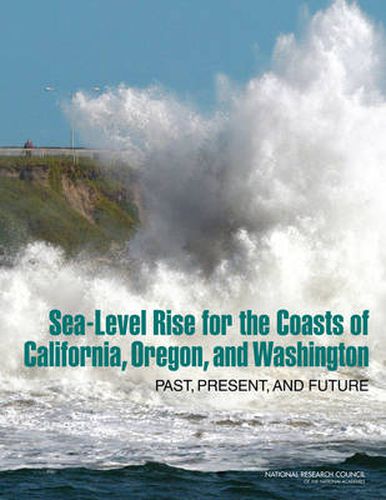
Tide gauges show that global sea level has risen about 7 inches during the 20th century, and recent satellite data show that the rate of sea-level rise is accelerating. As Earth warms, sea levels are rising mainly because ocean water expands as it warms; and water from melting glaciers and ice sheets is flowing into the ocean. Sea-level rise poses enormous risks to the valuable infrastructure, development, and wetlands that line much of the 1,600 mile shoreline of California, Oregon, and Washington. As those states seek to incorporate projections of sea-level rise into coastal planning, they asked the National Research Council to make independent projections of sea-level rise along their coasts for the years 2030, 2050, and 2100, taking into account regional factors that affect sea level.
Sea-Level Rise for the Coasts of California, Oregon, and Washington: Past, Present, and Future explains that sea level along the U.S. west coast is affected by a number of factors. These include: climate patterns such as the El Nino, effects from the melting of modern and ancient ice sheets, and geologic processes, such as plate tectonics. Regional projections for California, Oregon, and Washington show a sharp distinction at Cape Mendocino in northern California. South of that point, sea-level rise is expected to be very close to global projections. However, projections are lower north of Cape Mendocino because the land is being pushed upward as the ocean plate moves under the continental plate along the Cascadia Subduction Zone. However, an earthquake magnitude 8 or larger, which occurs in the region every few hundred to 1,000 years, would cause the land to drop and sea level to suddenly rise.
$9.00 standard shipping within Australia
FREE standard shipping within Australia for orders over $100.00
Express & International shipping calculated at checkout
Tide gauges show that global sea level has risen about 7 inches during the 20th century, and recent satellite data show that the rate of sea-level rise is accelerating. As Earth warms, sea levels are rising mainly because ocean water expands as it warms; and water from melting glaciers and ice sheets is flowing into the ocean. Sea-level rise poses enormous risks to the valuable infrastructure, development, and wetlands that line much of the 1,600 mile shoreline of California, Oregon, and Washington. As those states seek to incorporate projections of sea-level rise into coastal planning, they asked the National Research Council to make independent projections of sea-level rise along their coasts for the years 2030, 2050, and 2100, taking into account regional factors that affect sea level.
Sea-Level Rise for the Coasts of California, Oregon, and Washington: Past, Present, and Future explains that sea level along the U.S. west coast is affected by a number of factors. These include: climate patterns such as the El Nino, effects from the melting of modern and ancient ice sheets, and geologic processes, such as plate tectonics. Regional projections for California, Oregon, and Washington show a sharp distinction at Cape Mendocino in northern California. South of that point, sea-level rise is expected to be very close to global projections. However, projections are lower north of Cape Mendocino because the land is being pushed upward as the ocean plate moves under the continental plate along the Cascadia Subduction Zone. However, an earthquake magnitude 8 or larger, which occurs in the region every few hundred to 1,000 years, would cause the land to drop and sea level to suddenly rise.
Search our extensive online catalogue.
