Readings Newsletter
Become a Readings Member to make your shopping experience even easier.
Sign in or sign up for free!
You’re not far away from qualifying for FREE standard shipping within Australia
You’ve qualified for FREE standard shipping within Australia
The cart is loading…


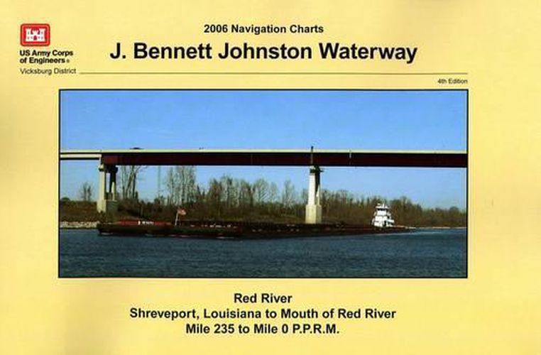
This paper navigational chart book is a 2016 illustrated reprint and covers the Red River Shreveport, Louisiana to Mouth of Red River Mile 235 to Mile 0 P.P.R.M. It was originally published in 2006, and is 11 x 17 in size.
U.S. Army Corps of Engineers paper navigational chart books are published to benefit both the professional and recreational maritime community. These chart books are spiral bound with sturdy covers and are designed for heavy service on any bridge. Mariners will find not only navigational charts within the pages of this chart book, but critical navigational safety information such as information pertaining to buoys, vertical clearances under bridges, warning to pleasure boaters and fisherman to include restricted and danger area boundaries; locks and dams; signals, lockage of tows; moorings and more. Well defined chart legends, and multiple indices make this chart book more than a simple navigational tool.
The U.S Coast Guard requires that commercial vessels operating in the waters represented within the pages of this chart book maintain on-board navigation charts or maps appropriate to the area of operation… (46 CFR Subchapter M). This chart book fulfills that requirement. However, it is incumbent on mariners to manually update these products and U.S. Coast Guard Notice to Mariners for changes and notices impacting these waters.
Related products:
Navigation Rules and Regulations Handbook 2014 – most recent edition can be found here: https: //bookstore.gpo.gov/products/sku/050-012-00517-6?ctid=127
United States Coast Guard Incident Management Handbook 2014 –most recent edition can be found here: https: //bookstore.gpo.gov/products/sku/050-012-00516-8?ctid=127
USACE Navigational Charts collection is available here: https: //bookstore.gpo.gov/catalog/transportation-navigation/almanacs-navigation-guides/usace-navigational-charts
Navigation by Water resources collection is available here: https: //bookstore.gpo.gov/catalog/transportation-navigation/almanacs-navigation-guides/navigation-water
Other products produced by the United States Army Corps of Engineers (USACE) can be found here: https: //bookstore.gpo.gov/agency/919
$9.00 standard shipping within Australia
FREE standard shipping within Australia for orders over $100.00
Express & International shipping calculated at checkout
This paper navigational chart book is a 2016 illustrated reprint and covers the Red River Shreveport, Louisiana to Mouth of Red River Mile 235 to Mile 0 P.P.R.M. It was originally published in 2006, and is 11 x 17 in size.
U.S. Army Corps of Engineers paper navigational chart books are published to benefit both the professional and recreational maritime community. These chart books are spiral bound with sturdy covers and are designed for heavy service on any bridge. Mariners will find not only navigational charts within the pages of this chart book, but critical navigational safety information such as information pertaining to buoys, vertical clearances under bridges, warning to pleasure boaters and fisherman to include restricted and danger area boundaries; locks and dams; signals, lockage of tows; moorings and more. Well defined chart legends, and multiple indices make this chart book more than a simple navigational tool.
The U.S Coast Guard requires that commercial vessels operating in the waters represented within the pages of this chart book maintain on-board navigation charts or maps appropriate to the area of operation… (46 CFR Subchapter M). This chart book fulfills that requirement. However, it is incumbent on mariners to manually update these products and U.S. Coast Guard Notice to Mariners for changes and notices impacting these waters.
Related products:
Navigation Rules and Regulations Handbook 2014 – most recent edition can be found here: https: //bookstore.gpo.gov/products/sku/050-012-00517-6?ctid=127
United States Coast Guard Incident Management Handbook 2014 –most recent edition can be found here: https: //bookstore.gpo.gov/products/sku/050-012-00516-8?ctid=127
USACE Navigational Charts collection is available here: https: //bookstore.gpo.gov/catalog/transportation-navigation/almanacs-navigation-guides/usace-navigational-charts
Navigation by Water resources collection is available here: https: //bookstore.gpo.gov/catalog/transportation-navigation/almanacs-navigation-guides/navigation-water
Other products produced by the United States Army Corps of Engineers (USACE) can be found here: https: //bookstore.gpo.gov/agency/919
Search our extensive online catalogue.
