Readings Newsletter
Become a Readings Member to make your shopping experience even easier.
Sign in or sign up for free!
You’re not far away from qualifying for FREE standard shipping within Australia
You’ve qualified for FREE standard shipping within Australia
The cart is loading…


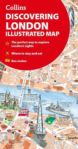
A new edition of London's most original map. This hand-watercoloured map contains individual paintings of all the main sites and landmarks, shop-by-shop street maps, theatres and cinemas, comprehensive travel information and index. This detailed map of Central London is at a scale of 1:8,250 (7.5 inches to 1 mile).
Coverage extends from Regent's Park in the north to Battersea in the south, and from Kensington in the west to Tower Bridge in the east.
This attractive and fact-filled map would make a lovely souvenir for the visitor to London.
The map features:
Railway stations, bus routes, London underground map, taxi ranks and car parks Shop-by-shop street maps for Oxford Street, Bond Street, Covent Garden, Portobello Road, King's Road, Brompton Cross, Exmouth Market, Beauchamp Place, St. Christopher's Place and South Molton Street, Knightsbridge, Jermyn Street and Kensington London's theatres and cinemas Places to eat, internet cafes and good places for a picnic An inset map of the City of London Comprehensive index Historical and contemporary anecdotes
Other titles in the series:
Discovering Edinburgh Discovering Glasgow
$9.00 standard shipping within Australia
FREE standard shipping within Australia for orders over $100.00
Express & International shipping calculated at checkout
A new edition of London's most original map. This hand-watercoloured map contains individual paintings of all the main sites and landmarks, shop-by-shop street maps, theatres and cinemas, comprehensive travel information and index. This detailed map of Central London is at a scale of 1:8,250 (7.5 inches to 1 mile).
Coverage extends from Regent's Park in the north to Battersea in the south, and from Kensington in the west to Tower Bridge in the east.
This attractive and fact-filled map would make a lovely souvenir for the visitor to London.
The map features:
Railway stations, bus routes, London underground map, taxi ranks and car parks Shop-by-shop street maps for Oxford Street, Bond Street, Covent Garden, Portobello Road, King's Road, Brompton Cross, Exmouth Market, Beauchamp Place, St. Christopher's Place and South Molton Street, Knightsbridge, Jermyn Street and Kensington London's theatres and cinemas Places to eat, internet cafes and good places for a picnic An inset map of the City of London Comprehensive index Historical and contemporary anecdotes
Other titles in the series:
Discovering Edinburgh Discovering Glasgow
Search our extensive online catalogue.
