Readings Newsletter
Become a Readings Member to make your shopping experience even easier.
Sign in or sign up for free!
You’re not far away from qualifying for FREE standard shipping within Australia
You’ve qualified for FREE standard shipping within Australia
The cart is loading…


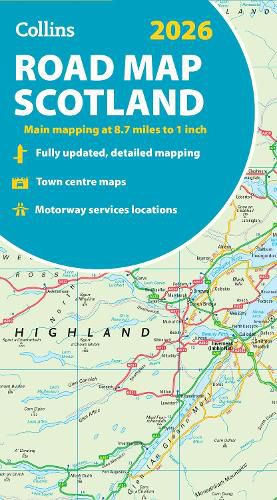
Explore Scotland with easy-to-read mapping from Collins. Full-colour map of Scotland at 8.7 miles to 1 inch, with clear road network and administrative areas shown in colour. The map covers the whole of Scotland and part of Northern England conveniently on one side, and is ideal for reference or route planning.
The map shows the road network in detail for easy route planning and has easily identifiable local council areas and boundaries.
The main features of this road map are:
Fully updated Administrative areas shown in colour Clear, detailed road network and road distances Town and city names, rivers, railway lines and canals are clearly shown 7 city/town centre street plans showing places of interest Index to place names Mileage chart Car ferry routes Key in English, French and German
$9.00 standard shipping within Australia
FREE standard shipping within Australia for orders over $100.00
Express & International shipping calculated at checkout
Explore Scotland with easy-to-read mapping from Collins. Full-colour map of Scotland at 8.7 miles to 1 inch, with clear road network and administrative areas shown in colour. The map covers the whole of Scotland and part of Northern England conveniently on one side, and is ideal for reference or route planning.
The map shows the road network in detail for easy route planning and has easily identifiable local council areas and boundaries.
The main features of this road map are:
Fully updated Administrative areas shown in colour Clear, detailed road network and road distances Town and city names, rivers, railway lines and canals are clearly shown 7 city/town centre street plans showing places of interest Index to place names Mileage chart Car ferry routes Key in English, French and German
Search our extensive online catalogue.
