Readings Newsletter
Become a Readings Member to make your shopping experience even easier.
Sign in or sign up for free!
You’re not far away from qualifying for FREE standard shipping within Australia
You’ve qualified for FREE standard shipping within Australia
The cart is loading…


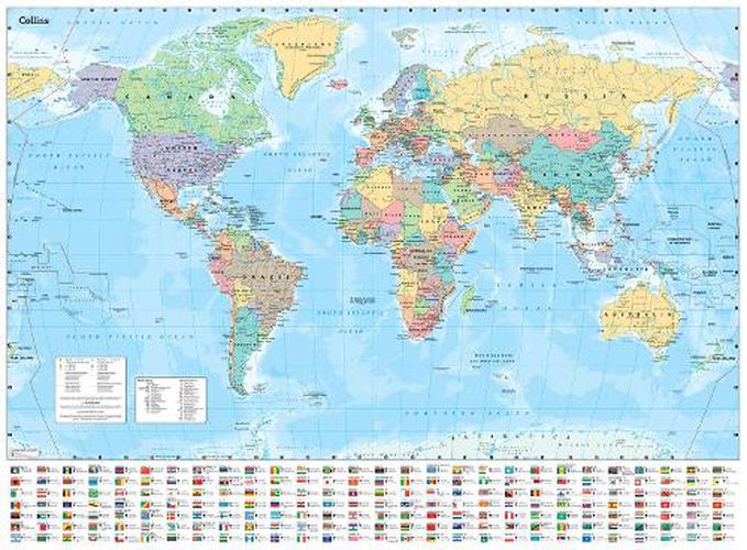
Explore the world with a Collins wall map Fully updated world map to include the latest political changes. The map contains politically coloured mapping which shows each country and their capital city, major roads, and cities and towns clearly. Also included are national flags, key statistics for every country and inset maps of the polar regions.
The map is printed on high quality paper and comes rolled in a fully recyclable cardboard box - ideal as a poster for any classroom, bedroom or office wall.
Area of coverage:
All of the world, centred on the Greenwich Meridian, and including maps of the North and South Pole regions.
Scale:
1:30 000 000; 1 cm to 300 km; 1 inch to 480 miles
Size:
700 x 915 mm (27.5 x 36 inches)
Other versions available:
Laminated flat map (ISBN 978-0-00-849254-0)
$9.00 standard shipping within Australia
FREE standard shipping within Australia for orders over $100.00
Express & International shipping calculated at checkout
Explore the world with a Collins wall map Fully updated world map to include the latest political changes. The map contains politically coloured mapping which shows each country and their capital city, major roads, and cities and towns clearly. Also included are national flags, key statistics for every country and inset maps of the polar regions.
The map is printed on high quality paper and comes rolled in a fully recyclable cardboard box - ideal as a poster for any classroom, bedroom or office wall.
Area of coverage:
All of the world, centred on the Greenwich Meridian, and including maps of the North and South Pole regions.
Scale:
1:30 000 000; 1 cm to 300 km; 1 inch to 480 miles
Size:
700 x 915 mm (27.5 x 36 inches)
Other versions available:
Laminated flat map (ISBN 978-0-00-849254-0)
Search our extensive online catalogue.
