Readings Newsletter
Become a Readings Member to make your shopping experience even easier.
Sign in or sign up for free!
You’re not far away from qualifying for FREE standard shipping within Australia
You’ve qualified for FREE standard shipping within Australia
The cart is loading…


The bestselling guides to Britain's canals and rivers for more than 50 years.
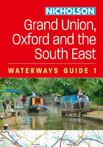
For all users of Britain's inland waterways. This established, popular and practical guide covers the canals and waterways between London and Birmingham.
Waterways covered in this guide - Chelmer & Blackwater Navigation, Grand Union Canal, Lee & Stort Navigations, River Medway, Oxford Canal, River Thames.
Guide includes; * Detailed Collins mapping at a scale of 2 inches = 1 mile, 3 cm = 1 km. * Descriptive text and accompanying images * Comprehensive navigational notes * Information about points of interest along the waterways, e.g. local landmarks, pubs, water points, etc.
Published for more than 50 years, the best-selling Collins Nicholson guides to the waterways have always been a vital part of journeys along Britain's canals and rivers. They are designed for anyone and everyone with an interest in Britain's inland waterways - from experienced boaters to those planning their first boat trip, as well as walkers, cyclists, and paddlers. This practical A5 guide features 'lie flat' spiral binding and 'book mark' back cover flap for ease of reference.
Comprehensive navigational notes include: * Maximum dimensions and low bridges * Mileages, advice and potential hazards * Navigation authorities and contact details
$9.00 standard shipping within Australia
FREE standard shipping within Australia for orders over $100.00
Express & International shipping calculated at checkout
The bestselling guides to Britain's canals and rivers for more than 50 years.
For all users of Britain's inland waterways. This established, popular and practical guide covers the canals and waterways between London and Birmingham.
Waterways covered in this guide - Chelmer & Blackwater Navigation, Grand Union Canal, Lee & Stort Navigations, River Medway, Oxford Canal, River Thames.
Guide includes; * Detailed Collins mapping at a scale of 2 inches = 1 mile, 3 cm = 1 km. * Descriptive text and accompanying images * Comprehensive navigational notes * Information about points of interest along the waterways, e.g. local landmarks, pubs, water points, etc.
Published for more than 50 years, the best-selling Collins Nicholson guides to the waterways have always been a vital part of journeys along Britain's canals and rivers. They are designed for anyone and everyone with an interest in Britain's inland waterways - from experienced boaters to those planning their first boat trip, as well as walkers, cyclists, and paddlers. This practical A5 guide features 'lie flat' spiral binding and 'book mark' back cover flap for ease of reference.
Comprehensive navigational notes include: * Maximum dimensions and low bridges * Mileages, advice and potential hazards * Navigation authorities and contact details
Search our extensive online catalogue.
