Readings Newsletter
Become a Readings Member to make your shopping experience even easier.
Sign in or sign up for free!
You’re not far away from qualifying for FREE standard shipping within Australia
You’ve qualified for FREE standard shipping within Australia
The cart is loading…


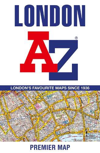
A full colour, single sided, fold-out street map, covering a six mile radius from Charing Cross in central London and extending to Muswell Hill to the north, London City Airport to the east, Crystal Palace to the south and Wembley to the west.
A clear 3 inches to 1 mile map, covering a six mile radius from Charing Cross. Postcode districts, one-way streets, the congestion zone boundary and the ultra low emission zone boundary are all featured on the mapping.
Attached to the cover is a booklet containing the index which lists streets, selected flats, walkways and places of interest and place, area and junction names. Also included are stations, hospitals and hospices covered by the map.
$9.00 standard shipping within Australia
FREE standard shipping within Australia for orders over $100.00
Express & International shipping calculated at checkout
A full colour, single sided, fold-out street map, covering a six mile radius from Charing Cross in central London and extending to Muswell Hill to the north, London City Airport to the east, Crystal Palace to the south and Wembley to the west.
A clear 3 inches to 1 mile map, covering a six mile radius from Charing Cross. Postcode districts, one-way streets, the congestion zone boundary and the ultra low emission zone boundary are all featured on the mapping.
Attached to the cover is a booklet containing the index which lists streets, selected flats, walkways and places of interest and place, area and junction names. Also included are stations, hospitals and hospices covered by the map.
Search our extensive online catalogue.
