Readings Newsletter
Become a Readings Member to make your shopping experience even easier.
Sign in or sign up for free!
You’re not far away from qualifying for FREE standard shipping within Australia
You’ve qualified for FREE standard shipping within Australia
The cart is loading…


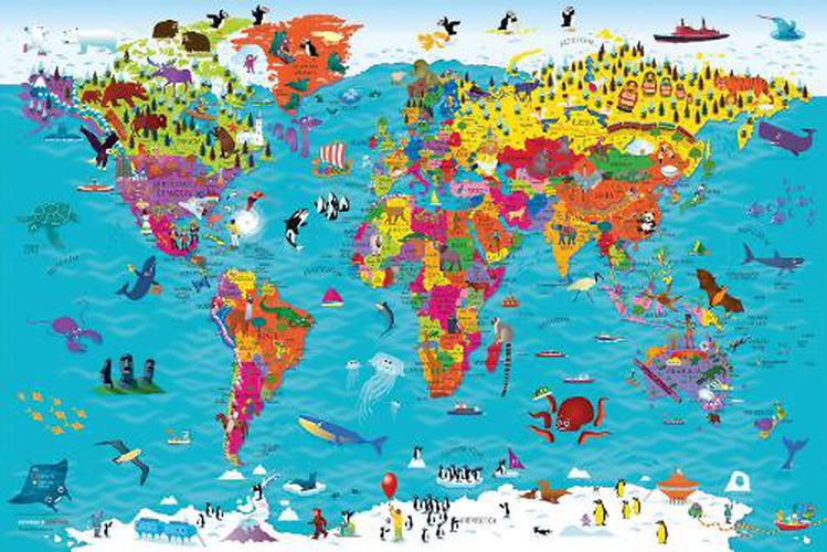
Beautifully illustrated wall map for inquisitive kids Colourful Illustrated Map of the World
This bestselling, highly illustrated pictorial map is designed to take children on a journey of discovery around the countries of the world. The mapping is up-to-date, colourful and highly informative and shows countries and capital cities.
Stunning illustrations are used to depict themes such as national emblems, customs, food, birds, animals, buildings and sports to help younger readers gain an understanding of the world.
Dimensions 610 X 915 mm / 24 x 36 inches
Illustrated by Steve Evans.
Now with barcode removed due to popular demand from our customers.
$9.00 standard shipping within Australia
FREE standard shipping within Australia for orders over $100.00
Express & International shipping calculated at checkout
Beautifully illustrated wall map for inquisitive kids Colourful Illustrated Map of the World
This bestselling, highly illustrated pictorial map is designed to take children on a journey of discovery around the countries of the world. The mapping is up-to-date, colourful and highly informative and shows countries and capital cities.
Stunning illustrations are used to depict themes such as national emblems, customs, food, birds, animals, buildings and sports to help younger readers gain an understanding of the world.
Dimensions 610 X 915 mm / 24 x 36 inches
Illustrated by Steve Evans.
Now with barcode removed due to popular demand from our customers.
Search our extensive online catalogue.
