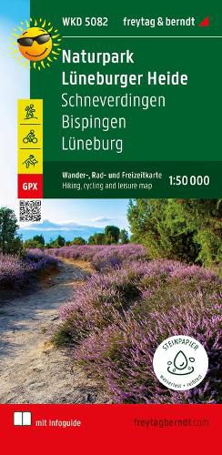
Lueneburg Heath Nature Park, hiking, cycling and leisure map 1:50,000, freytag & berndt, WKD 5082, with info guide

Lueneburg Heath Nature Park, hiking, cycling and leisure map 1:50,000, freytag & berndt, WKD 5082, with info guide
The Lueneburg Heath Nature Park hiking, cycling and leisure map covers the entire area on a scale of 1:50,000. In the north-east of the map is the district and Hanseatic city of Lueneburg, in the south-east the section extends to Ebstorf with its monastery of the same name. Heath towns and villages such as Schneverdingen and Bispingen are also shown on the map sheet. The Lueneburg Heath with its unique flora and fauna offers hikers, cyclists and horseback riders a real Eldorado with a variety of paths. The historic cultivated land is ideally suited to be explored on foot, by bike or on horseback.
Information on the Lueneburg Heath Nature Park hiking map
Hiking and long-distance hiking trails Cycle and long-distance cycle paths bridle paths GPX-Tracks zum Download Scale 1:50 000 Waterproof and tear resistant 70 x 82 cm, printed on both sides In a practical map sleeve with info guide Info guide The enclosed "short & compact" info guide makes the region around the Lueneburg Heath Nature Park palatable for hikers and cyclists. Natural and cultural features, the development of the nature reserve and traditional management methods in the heath region are presented in more detail. Original heathland villages - above all car-free Wilsede - are waiting to be discovered. Small heath towns such as Schneverdingen and Soltau are ideal as a starting point for excursions to the heath region and the old salt and Hanseatic city of Lueneburg attracts with a large number of historical buildings. Heidschnuckenweg and Freudenthalweg, the two important long-distance hiking trails are described in more detail. Also, we have a choice of sixTop hikes with the most important facts about the route, a short description and an elevation profile included in the info guide. In addition to the Lueneburg Heath Tour and the Luhe Cycle Path, several long- distance cycle paths also run through the vast areas of the Lueneburg Heath Nature Park. The diverse range of cycle paths is supplemented by the heathland tours. A separate section is dedicated to these three themed cycle paths, rounded off by our three top cycle tours with route information, descriptions and elevation profiles.
Waterproof and tear-resistant The hiking map is printed on a special waterproof and durable paper so that it can also be used for orientation on rainy days.
Manufactured in a way that conserves resources The map consists of 80% ground limestone. The production is much more resource-saving than with conventional paper because the consumption of water, wood and energy is significantly lower.
This item is not currently in-stock. It can be ordered online and is expected to ship in approx 4 weeks
Our stock data is updated periodically, and availability may change throughout the day for in-demand items. Please call the relevant shop for the most current stock information. Prices are subject to change without notice.
Sign in or become a Readings Member to add this title to a wishlist.


