


Political Europe, wall map 1:2,600,000, magnetic marking board, freytag & berndt
Political Europe, wall map 1:2,600,000, magnetic marking board, freytag & berndt
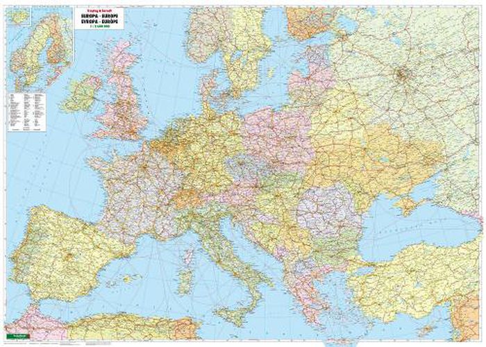
The political wall map of Europe 1:2,600,000 offers a good overview of the countries of Europe. In addition to the highways and main traffic routes, it shows large cities, important places, rivers and lakes. Distances are shown in kilometers. The countries are shown in multiple colors to make them easier to distinguish. The wall map is laminated to a very light but stable plastic plate, covered with a UV-resistant magnetic film and framed with a silver-coated aluminum frame.
Magnetic marking board Europe 1:2,600,000
Magnetic Can be written on and wiped clean Places can be marked with marking needles and pins The hanging device is not visible Large format: approx. 172 x 123 cm The weight: approx. 6 kg
This item is not currently in-stock. It can be ordered online and is expected to ship in approx 4 weeks
Our stock data is updated periodically, and availability may change throughout the day for in-demand items. Please call the relevant shop for the most current stock information. Prices are subject to change without notice.
Sign in or become a Readings Member to add this title to a wishlist.