


The Palisades Trail Map
Tom Harrison
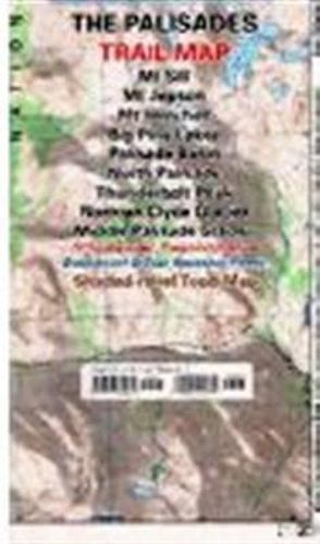
The Palisades Trail Map
Tom Harrison
The Palisades Trail Map covers the Big Creek area of the eastern Sierra on the boundary between Kings Canyon National Park and Inyo National Forest. It includes the Palisades and Norman Clyde Glaciers, Bishop and Mather Pass, and the Big Pine Lakes. Printed on waterproof & tear resistant plastic.
This item is not currently in-stock. It can be ordered online and is expected to ship in approx 4 weeks
Our stock data is updated periodically, and availability may change throughout the day for in-demand items. Please call the relevant shop for the most current stock information. Prices are subject to change without notice.
Sign in or become a Readings Member to add this title to a wishlist.