


Hadrian's Wall Path Map Booklet: 1:25,000 OS Route Mapping
Hadrian’s Wall Path Map Booklet: 1:25,000 OS Route Mapping
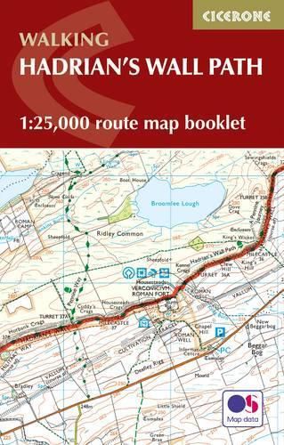
Map of the 84-mile (135km) Hadrian’s Wall Path National Trail, from Bowness-on-Solway to Wallsend, Newcastle. The trail typically takes a week to walk, and is suitable for walkers at all levels of experience. This compact booklet of Ordnance Survey 1:25,000 maps shows the full route, providing all of the mapping you need to complete the trail.
This item is not currently in-stock. It can be ordered online and is expected to ship in approx 2 weeks
Our stock data is updated periodically, and availability may change throughout the day for in-demand items. Please call the relevant shop for the most current stock information. Prices are subject to change without notice.
Sign in or become a Readings Member to add this title to a wishlist.