


Settle to Carlisle Way: XT40
Harvey Map Services Ltd.
Settle to Carlisle Way: XT40
Harvey Map Services Ltd.
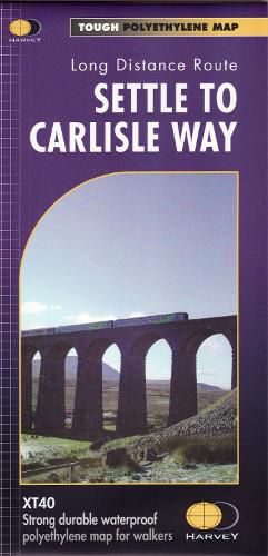
Settle to Carlisle Way. This 138km (97mls)long distance walking route traces the line of the famous Settle Carlisle line. It links all the stations along the way so that you can walk a day section, or the whole route staying in local accommodation. There are many ways of linking Settle and Carlisle, and this suggested walk takes in the highlights of the Ribble Way and the Eden Way. The route follows rights of way. It is not waymarked other than the usual public footpath / bridleway signs. Along the way you get to see some of the masterpieces of Victorian engineering that made the railway possible. XT40, a new generation of tough polyethylene maps. The HARVEY series of Long Distance Route maps is an established success. Now the advanced technology used in the creation of our best-selling British Mountain Maps is also applied to the route maps. These maps are a leap forward in technical excellence. They are tough, durable, light and 100% waterproof virtually indestructible in normal use. They are light to carry, and compact not the great bulky package you get with a laminated map. The map is detailed,with the routes clearly marked. It also contains general information, useful telephone numbers and a full key.
This item is not currently in-stock. It can be ordered online and is expected to ship in approx 4 weeks
Our stock data is updated periodically, and availability may change throughout the day for in-demand items. Please call the relevant shop for the most current stock information. Prices are subject to change without notice.
Sign in or become a Readings Member to add this title to a wishlist.