


Collection of Four Historic Maps of Manchester from 1807-1876
Mapseeker Publishing Ltd.
Collection of Four Historic Maps of Manchester from 1807-1876
Mapseeker Publishing Ltd.
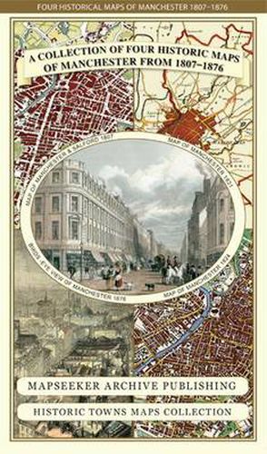
This folded map (890mm 1000mm when unfolded) is an ideal souvenir for tourists to Manchester and also a valuable reference resource for local and family history research. It includes 4 historic maps of Manchester, a Plan of Manchester by Cole and Roper 1807, a Plan of Manchester by William Swire’s 1824, a Plan of Manchester by Dawson 1831, as well as a Bird’s Eye View of Manchester from 1876 and a much earlier Plan of Manchester from 1650. All the maps have been meticulously re-produced from antique originals and printed on 90 gsm Progeo paper which was specially developed as a map paper. It has high opacity to help reduce show through and a cross grain giving it greater durability to as the map is being folded.
This item is not currently in-stock. It can be ordered online and is expected to ship in approx 2 weeks
Our stock data is updated periodically, and availability may change throughout the day for in-demand items. Please call the relevant shop for the most current stock information. Prices are subject to change without notice.
Sign in or become a Readings Member to add this title to a wishlist.