Readings Newsletter
Become a Readings Member to make your shopping experience even easier.
Sign in or sign up for free!
You’re not far away from qualifying for FREE standard shipping within Australia
You’ve qualified for FREE standard shipping within Australia
The cart is loading…


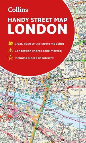
An essential companion whether you are travelling around London by car, public transport or on foot.
Clear and easy-to-read map of central London and surrounding area. Contains detailed mapping, presented in a handy compact format.
This attractive map, ideal for both tourists and residents, and fully updated, has an extensive area of coverage and displays a wealth of detail.
This map includes: * New for this edition: Electric car recharging sites * Fully classified roads * Congestion charging zone & T-charge (Ultra Low Emission Zone from April 2019) * Postal districts and boundaries clearly depicted * Full indexes to street names (on back of map), place names and places of interest * Fully updated London underground map conveniently located on the back cover
Covers this area: Extends from Hampstead in the north to Clapham in the south and from Hammersmith in the west to Greenwich in the east.
Scale: 1:17,500 (3.6 inches to 1 mile)
$9.00 standard shipping within Australia
FREE standard shipping within Australia for orders over $100.00
Express & International shipping calculated at checkout
An essential companion whether you are travelling around London by car, public transport or on foot.
Clear and easy-to-read map of central London and surrounding area. Contains detailed mapping, presented in a handy compact format.
This attractive map, ideal for both tourists and residents, and fully updated, has an extensive area of coverage and displays a wealth of detail.
This map includes: * New for this edition: Electric car recharging sites * Fully classified roads * Congestion charging zone & T-charge (Ultra Low Emission Zone from April 2019) * Postal districts and boundaries clearly depicted * Full indexes to street names (on back of map), place names and places of interest * Fully updated London underground map conveniently located on the back cover
Covers this area: Extends from Hampstead in the north to Clapham in the south and from Hammersmith in the west to Greenwich in the east.
Scale: 1:17,500 (3.6 inches to 1 mile)
Search our extensive online catalogue.
