


Children's Wall Map of the United Kingdom and Ireland
Collins Kids
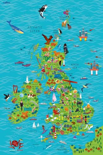
Children’s Wall Map of the United Kingdom and Ireland
Collins Kids
Colourful Illustrated Map of the United Kingdom and Ireland
This highly illustrated, rolled pictorial map is designed to take children on a journey of discovery around the United Kingdom and Ireland.
Stunning illustrations are used to depict themes such as national emblems, customs, food, birds, animals, buildings and sports to help younger readers gain an understanding of peoples around the world.
Illustrated by Steve Evans.
This item is not currently in-stock. It can be ordered online and is expected to ship in approx 2 weeks
Our stock data is updated periodically, and availability may change throughout the day for in-demand items. Please call the relevant shop for the most current stock information. Prices are subject to change without notice.
Sign in or become a Readings Member to add this title to a wishlist.