Readings Newsletter
Become a Readings Member to make your shopping experience even easier.
Sign in or sign up for free!
You’re not far away from qualifying for FREE standard shipping within Australia
You’ve qualified for FREE standard shipping within Australia
The cart is loading…


This title is printed to order. This book may have been self-published. If so, we cannot guarantee the quality of the content. In the main most books will have gone through the editing process however some may not. We therefore suggest that you be aware of this before ordering this book. If in doubt check either the author or publisher’s details as we are unable to accept any returns unless they are faulty. Please contact us if you have any questions.
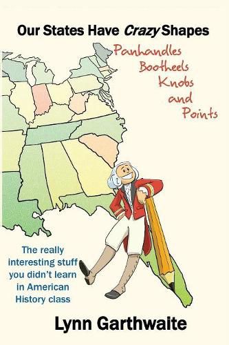
Our States Have Crazy Shapes is a book that describes in layman’s terms the behind-the-scenes decisions that caused our leaders to carve odd shapes on our map. Who decided that Michigan should have the Upper Peninsula when that landmass is actually attached to Wisconsin? What’s up with that bootheel, Missouri? Why did the shapes of our states get noticeably square as we moved west? Why are some of our states so big and others so small? Our States Have Crazy Shapes answers these questions and more. Bonus chapters describe border battles that continue to this day, as well as how Mother Nature has played a part in creating our map outlines. Debates on where to divide two states, or border wars in which two sides claimed rights to the same property, often reflected events in our country or the influence of powerful and persuasive people. The Missouri bootheel exists because of a wealthy Arkansas landowner who lobbied Congress to include his property in Missouri. The panhandle of Oklahoma exists because of the division in our country over slavery. Every state has a story, and every story defines our country. Each state has its own chapter and the chapters are presented in the order in which the states were ratified. Easy-to-read maps help the reader understand the evolution of how colonies became territories and how territories became states. For educators, the book addresses 23 (Minnesota) State Standards for grades 4-9. Readers of this book, in search of interesting trivia, will find they accidentally learn some fascinating American history.
$9.00 standard shipping within Australia
FREE standard shipping within Australia for orders over $100.00
Express & International shipping calculated at checkout
This title is printed to order. This book may have been self-published. If so, we cannot guarantee the quality of the content. In the main most books will have gone through the editing process however some may not. We therefore suggest that you be aware of this before ordering this book. If in doubt check either the author or publisher’s details as we are unable to accept any returns unless they are faulty. Please contact us if you have any questions.
Our States Have Crazy Shapes is a book that describes in layman’s terms the behind-the-scenes decisions that caused our leaders to carve odd shapes on our map. Who decided that Michigan should have the Upper Peninsula when that landmass is actually attached to Wisconsin? What’s up with that bootheel, Missouri? Why did the shapes of our states get noticeably square as we moved west? Why are some of our states so big and others so small? Our States Have Crazy Shapes answers these questions and more. Bonus chapters describe border battles that continue to this day, as well as how Mother Nature has played a part in creating our map outlines. Debates on where to divide two states, or border wars in which two sides claimed rights to the same property, often reflected events in our country or the influence of powerful and persuasive people. The Missouri bootheel exists because of a wealthy Arkansas landowner who lobbied Congress to include his property in Missouri. The panhandle of Oklahoma exists because of the division in our country over slavery. Every state has a story, and every story defines our country. Each state has its own chapter and the chapters are presented in the order in which the states were ratified. Easy-to-read maps help the reader understand the evolution of how colonies became territories and how territories became states. For educators, the book addresses 23 (Minnesota) State Standards for grades 4-9. Readers of this book, in search of interesting trivia, will find they accidentally learn some fascinating American history.
Search our extensive online catalogue.
